The Annex | |
|---|---|
Neighbourhood | |
 St. George Street, north of Bloor Street | |
 | |
| Coordinates: 43°40′12″N 79°24′14″W / 43.670°N 79.404°W | |
| Country | Canada |
| Province | Ontario |
| City | Toronto |
| Government | |
| • MP | Chrystia Freeland (University—Rosedale) |
| • MPP | Jessica Bell (University—Rosedale) |
| • Councillor | Dianne Saxe (Ward 11 University-Rosedale) |
| Area | |
| • Total | 1.460 km2 (0.564 sq mi) |
| Population (2021)[1] | |
| • Total | 14,140 |
| • Density | 9,685/km2 (25,080/sq mi) |
| Demonym | Annegonian [2] |
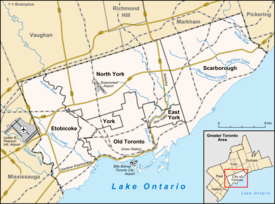
The Annex is a neighbourhood in Downtown Toronto, Ontario, Canada. The traditional boundaries of the neighbourhood are north to Dupont Street, south to Bloor Street, west to Bathurst Street and east to Avenue Road.[3] The City of Toronto recognizes a broader neighbourhood definition that includes the adjacent Seaton Village and Yorkville areas.[4]
Bordering the University of Toronto, the Annex has long been a student quarter, and it is also home to many fraternity houses and members of the university's faculty.[5] According to the 2011 Canadian census, the neighbourhood has an average income of $66,742.67, significantly above the average income in the Toronto census metropolitan area.
The Annex is not known for its big population of immigrants – in 2011, Statistics Canada declared that there were about 4,665 immigrants (predominantly from the United Kingdom and the United States) living in the area. As of the 2021 census, the three census tracts that compose the Annex have a total population of 14,149 and an average population density of 9,685 people/km2.[6]
- ^ GeoSearch
- ^ "Let's Make a Deal". The Globe and Mail.
- ^ "Toronto Neighbourhoods Net Boundaries". TorontoNeighbourhoods.Net. Archived from the original on January 25, 2011. Retrieved July 6, 2008.
- ^ "The Annex Neighbourhood profile". City of Toronto. July 14, 2017.
- ^ Ley, David (1996). The New Middle Class and the Remaking of the Central City. Oxford University Press. p. 182. ISBN 0-19-823292-6.
- ^ "GeoSearch".
