| Thursday Island Queensland | |||||||||||||||
|---|---|---|---|---|---|---|---|---|---|---|---|---|---|---|---|
 View of the township of Thursday Island | |||||||||||||||
| Coordinates | 10°35′06″S 142°13′14″E / 10.585°S 142.2205°E | ||||||||||||||
| Population | 2,805 (2021 census)[1] | ||||||||||||||
| • Density | 801/km2 (2,076/sq mi) | ||||||||||||||
| Postcode(s) | 4875 | ||||||||||||||
| Elevation | 8.0 m (26 ft) | ||||||||||||||
| Area | 3.5 km2 (1.4 sq mi) | ||||||||||||||
| Time zone | AEST (UTC+10:00) | ||||||||||||||
| LGA(s) | Shire of Torres | ||||||||||||||
| State electorate(s) | Cook | ||||||||||||||
| Federal division(s) | Leichhardt | ||||||||||||||
| |||||||||||||||
| |||||||||||||||
Native name: Waiben Nickname: TI | |
|---|---|
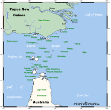
 A map of the Torres Strait Islands showing 'Waiben' in the south-western waters of Torres Strait | |
| Geography | |
| Location | Northern Australia |
| Archipelago | Torres Strait Islands |
| Adjacent to | Torres Strait |
| Area | 3.5 km2 (1.4 sq mi) |
| Highest elevation | 104 m (341 ft) |
| Administration | |
| State | Queensland |
Thursday Island, colloquially known as TI, or in the Kawrareg dialect,[2] Waiben or Waibene,[3] is an island of the Torres Strait Islands, an archipelago of at least 274 small islands in the Torres Strait. TI is located approximately 39 kilometres (24 miles) north of Cape York Peninsula in Far North Queensland, Australia.[4]
Thursday Island is also the name of the town in the south and west of the island, formerly known as Port Kennedy, and also the name of the locality which contains the island within the Shire of Torres.[5][6] The town of Rose Hill (known as Abednego until 7 September 1991) is located on the north-eastern tip of the island (10°34′11″S 142°13′30″E / 10.5698°S 142.2250°E).[7]
In the 2021 census, the locality of Thursday Island had a population of 2,805 people.[1]
- ^ a b Cite error: The named reference
Census2021was invoked but never defined (see the help page). - ^ "Torres Strait Islander everyday words". State Library Of Queensland. 21 June 2017. Archived from the original on 5 April 2020. Retrieved 11 March 2020.
- ^ Williamson, Patricia (18 October 2018). "Gab Titui annual art awards". National Museum of Australia. Archived from the original on 30 April 2020. Retrieved 11 March 2020.
- ^ "Thursday Island – island in the Shire of Torres (entry 34475)". Queensland Place Names. Queensland Government. Retrieved 2 November 2019.
- ^ "Thursday Island – town in Shire of Torres (entry 34477)". Queensland Place Names. Queensland Government. Retrieved 11 June 2019.
- ^ "Thursday Island – locality in Shire of Torres (entry 41959)". Queensland Place Names. Queensland Government. Retrieved 11 June 2019.
- ^ "Rose Hill – town in Shire of Torres (entry 21)". Queensland Place Names. Queensland Government. Retrieved 11 June 2019.
