| Timor Victoria | |
|---|---|
 Bowenvale-Timor General Store, closed in 1997 | |
| Coordinates | 36°59′3″S 143°42′33″E / 36.98417°S 143.70917°E |
| Population | 68 (SAL 2021)[1] |
| Postcode(s) | 3465 |
| Location |
|
| LGA(s) | Shire of Central Goldfields |
| State electorate(s) | Ripon |
| Federal division(s) | Mallee |
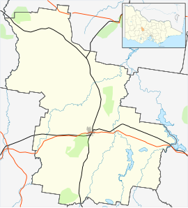
Timor (/ˈtaɪˈmɔː/), short-speak for the adjoining localities of Bowenvale and Timor, in the Central Goldfields Shire of Victoria, Australia. Their shared boundary is 8 kilometres (5 mi) north of Maryborough, Victoria and 178 kilometres (111 mi) northwest of Melbourne, the state capital.
The 2021 Australian Census has the populations of the statistical divisions being 209 in Bowenvale (an increase of 21 over 2016) [2] 68 in Timor (10 ditto) ,[3] and 23 in Timor West (one less ditto).[4]
- ^ Australian Bureau of Statistics (28 June 2022). "Timor (Vic.) (suburb and locality)". Australian Census 2021 QuickStats. Retrieved 28 June 2022.
- ^ Australian Bureau of Statistics (23 October 2017). "2016 Census QuickStats: Bowenvale". Retrieved 2 November 2021.
- ^ Australian Bureau of Statistics (23 October 2017). "2016 Census QuickStats: Timor (Vic.)". Retrieved 2 November 2021.
- ^ Australian Bureau of Statistics (23 October 2017). "2016 Census QuickStats: Timor West". Retrieved 2 November 2021.
