Tisbury, Massachusetts | |
|---|---|
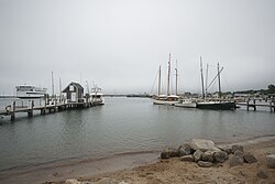
 Vineyard Haven Harbor | |
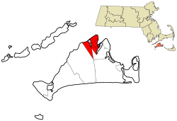
 Location in Dukes County in Massachusetts | |
| Coordinates: 41°27′22″N 70°36′40″W / 41.45611°N 70.61111°W | |
| Country | United States |
| State | Massachusetts |
| County | Dukes |
| Settled | 1660 |
| Incorporated | July 8, 1671 |
| Government | |
| • Type | Open town meeting |
| Area | |
| • Total | 19.1 sq mi (49.5 km2) |
| • Land | 6.5 sq mi (16.9 km2) |
| • Water | 12.6 sq mi (32.6 km2) |
| Elevation | 89 ft (27 m) |
| Population (2020) | |
| • Total | 4,815 |
| • Density | 738/sq mi (284.9/km2) |
| Time zone | UTC-5 (Eastern) |
| • Summer (DST) | UTC-4 (Eastern) |
| ZIP code | 02568 |
| Area code | 508 / 774 |
| FIPS code | 25-69940 |
| GNIS feature ID | 0619443 |
| Website | www |
Tisbury is a town located on Martha's Vineyard in Dukes County, Massachusetts, United States. The population was 4,815 at the 2020 census.[1]
Vineyard Haven is the main village/town center of Tisbury. The two names are used interchangeably.[2] As can be seen in the history section below, the town of Tisbury was incorporated within the Commonwealth of Massachusetts in 1671, and remains the legal name of the town to this day. However, the port and harbor have had varying names. "Holmes Hole" was one of the first names of the port within the town of Tisbury. This name was later changed to "Vineyard Haven", which is the official post office name for the community. To residents of Martha's Vineyard, "Vineyard Haven" is by far the more common usage, although residents recognize Tisbury as the town's legal name.
Vineyard Haven in Tisbury is the main port of entrance to Martha's Vineyard, and is the only operational port on the island during most of the year.
- ^ "Census - Geography Profile: Tisbury town, Dukes County, Massachusetts". U.S. Census Bureau. Retrieved November 7, 2021.
- ^ "Martha's Vineyard Villages & Towns". Martha's Vineyard Online. Retrieved October 14, 2008.

