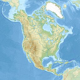
| Togiak Lake | |
|---|---|
| Location | Dillingham Census Area, Alaska, United States |
| Coordinates | 59°38′2″N 159°36′28″W / 59.63389°N 159.60778°W[1] |
| Primary inflows | Izavieknik River |
| Basin countries | United States |
| Max. length | 13 miles (21 km)[1] |
| Surface elevation | 220 feet (67 m)[1] |
| Little Togiak Lake | |
|---|---|
| Location | Dillingham Census Area, Alaska, United States |
| Coordinates | 59°34′32″N 159°8′58″W / 59.57556°N 159.14944°W[2] |
| Basin countries | United States |
| Max. length | 6 miles (9.7 km)[2] |
| Surface elevation | 39 feet (12 m)[2] |
| Upper Togiak Lake | |
|---|---|
| Location | Dillingham Census Area, Alaska, United States |
| Coordinates | 59°50′13″N 159°28′34″W / 59.83694°N 159.47611°W[3] |
| Basin countries | United States |
| Max. length | 5 miles (8.0 km)[3] |
| Surface elevation | 302 feet (92 m)[3] |
| West Togiak Lake | |
|---|---|
| Location | Dillingham Census Area, Alaska, United States |
| Coordinates | 59°38′37″N 159°38′22″W / 59.64361°N 159.63944°W[4] |
| Basin countries | United States |
| Surface elevation | 230 feet (70 m)[4] |
Togiak Lake is a 13-mile (21 km) lake in the U.S. state of Alaska, which extends South-West from mouth of Izavieknik River, 75 miles (121 km) northeast of Goodnews Bay, Kilbuck-Kuskokwim Mountains.[1]
- ^ a b c d "Togiak Lake)". Geographic Names Information System. United States Geological Survey, United States Department of the Interior. Retrieved 2009-05-04.
- ^ a b c "Little Togiak Lake". Geographic Names Information System. United States Geological Survey, United States Department of the Interior. Retrieved 2009-05-04.
- ^ a b c "Upper Togiak Lake". Geographic Names Information System. United States Geological Survey, United States Department of the Interior. Retrieved 2009-05-04.
- ^ a b "West Togiak Lake". Geographic Names Information System. United States Geological Survey, United States Department of the Interior. Retrieved 2009-05-04.

