Topo | |
|---|---|
 The islet of the parish of Topo is the extreme easterly extension of the island of São Jorge, as seen from the villa of Topo | |
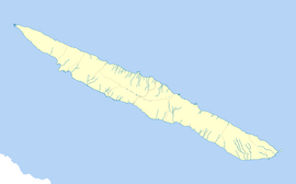
| Coordinates: 38°32′55″N 27°46′3″W / 38.54861°N 27.76750°W | |
| Country | |
| Auton. region | Azores |
| Island | São Jorge |
| Municipality | Calheta |
| Established | Settlement: c. 1480 |
| Area | |
| • Total | 9.24 km2 (3.57 sq mi) |
| Elevation | 136 m (446 ft) |
| Population (2011) | |
| • Total | 508 |
| • Density | 55/km2 (140/sq mi) |
| Time zone | UTC−01:00 (AZOT) |
| • Summer (DST) | UTC±00:00 (AZOST) |
| Postal code | 9875-165 |
| Area code | 292 |
| Patron | Nossa Senhora do Rosário |
Topo, also known as Nossa Senhora do Rosário, is a freguesia ("civil parish") on the northeastern corner of the municipality Calheta on the island of São Jorge. It is considered the first settlement on the island of São Jorge to attain the status of municipality; from 1510 to 1867 "Vila do Topo" was the municipal seat of Topo, which included the neighboring parish of Santo Antão. The population in 2011 was 508,[1] in an area of 9.24 km2.[2]

