Torvastad Municipality
Torvastad herred | |
|---|---|
| Torvestad herred (historic name) | |
 Rogaland within Norway | |
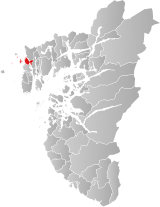
 Torvastad within Rogaland | |
| Coordinates: 59°22′49″N 05°14′13″E / 59.38028°N 5.23694°E | |
| Country | Norway |
| County | Rogaland |
| District | Haugaland |
| Established | 1 Jan 1838 |
| • Created as | Formannskapsdistrikt |
| Disestablished | 1 Jan 1965 |
| • Succeeded by | Haugesund and Karmøy municipalities |
| Administrative centre | Torvastad |
| Area (upon dissolution) | |
| • Total | 26 km2 (10 sq mi) |
| Population (1965) | |
| • Total | 3,853 |
| • Density | 150/km2 (380/sq mi) |
| Demonym | Torvastadbu[1] |
| Time zone | UTC+01:00 (CET) |
| • Summer (DST) | UTC+02:00 (CEST) |
| ISO 3166 code | NO-1152[2] |
Torvastad is a former municipality in Rogaland county, Norway. The municipality existed from 1838 until 1965. The administrative centre was the village of Haugesund (from 1838 until 1855), and after that it was the village of Torvastad on the island of Karmøy. Today, the area of Torvastad refers to the northern part of the municipality (and island) of Karmøy.[3]
Torvastad municipality originally encompassed parts of the present-day municipalities of Haugesund, Utsira, and Karmøy. The municipality included the northwesternmost part of the mainland of Rogaland county plus the northern part of the island of Karmøy and the islands of Utsira, Røvær, Vibrandsøy, and Feøy. Upon its dissolution in 1965, the municipality was 26 square kilometres (10 sq mi).[3]
- ^ "Navn på steder og personer: Innbyggjarnamn" (in Norwegian). Språkrådet.
- ^ Bolstad, Erik; Thorsnæs, Geir, eds. (26 January 2023). "Kommunenummer". Store norske leksikon (in Norwegian). Kunnskapsforlaget.
- ^ a b Cite error: The named reference
snlwas invoked but never defined (see the help page).