| Toxteth | |
|---|---|
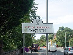
 Toxteth sign on Croxteth Road near Sefton Park, Liverpool | |
Location within Merseyside | |
| OS grid reference | SJ355885 |
| Metropolitan borough | |
| Metropolitan county | |
| Region | |
| Country | England |
| Sovereign state | United Kingdom |
| Post town | LIVERPOOL |
| Postcode district | L8 |
| Dialling code | 0151 |
| Police | Merseyside |
| Fire | Merseyside |
| Ambulance | North West |
| UK Parliament | |
Toxteth is an inner-city area of Liverpool in the county of Merseyside.
Toxteth is located to the south of Liverpool city centre, bordered by Aigburth, Canning, Dingle, and Edge Hill.
The area was originally part of a royal park and known as Toxteth Park. It remained predominantly rural up until the 18th century. Toxteth was then developed during this time and into the 19th century, mainly as a residential area to accommodate the increasing working-class community centred on Liverpool following the Industrial Revolution. The Welsh Streets in Toxteth were constructed in the mid-19th century to accommodate this demand. Immigration continued into the 20th century, resulting in a significant number of ethnic minority communities in the area.
Toxteth was badly hit by economic stagnation and unemployment in the late 1970s, culminating in riots in July 1981. Although attempts have been made to regenerate the area and improve living standards, significant problems with unemployment and crime remain into the 21st century. Many Victorian properties in the area continue to lie derelict awaiting redevelopment.
