| Trams in Greater Cairo | |||
|---|---|---|---|
 Cairo Tram | |||
| Overview | |||
| Locale | Greater Cairo, Egypt | ||
| Transit type | Tram | ||
| Operation | |||
| Began operation | 12 August 1896[1]
   | ||
| Operator(s) | Cairo Transportation Authority (CTA) | ||
| |||
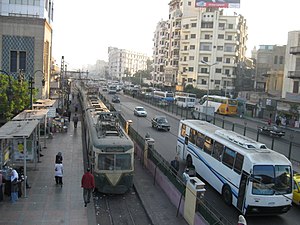
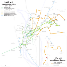
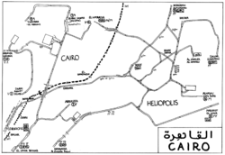
Constructed near the beginning of the 20th century, until 2014 the Cairo tramway network was still used in modern-day Cairo, especially in modern areas, like Heliopolis and Nasr City. During the 1970s, government policies favoured making space for cars, resulting in the removal of over half of the 120-kilometre (75 mi) network. Trams were removed entirely from central Cairo but continued to run in Heliopolis and Helwan.[2]

However, Helwan's part of the system shut down completely in the aftermath of the 2011 Egyptian revolution,[2] and in 2014–2015 the surviving tram service in Heliopolis was almost entirely discontinued. Only a short section of one line in Heliopolis, between Court Square and the Tivoli Dome, continued to be operated.[3] By the end of 2019, service had ceased definitively, with tracks dismantled in order to widen the neighborhood's roads as well as to build bridges above the tracks.[4]
- ^ Abdel Rahman, Ahmed (28 December 2019). قصة مواصلات المصريين.. من الحنطور إلى الحافلة الكهربائية [The story of Egyptian transportation... from the cab to the electric bus]. Al Jazeera (in Arabic). Retrieved 2020-02-19.
- ^ a b "On Cairo's dying trams". cairobserver.com. 30 August 2012. Retrieved 2019-03-07.
- ^ Lücker, Christian (22 June 2018). "Mega-City mit Rumpel-Tram" [Mega-city with rumble tram]. Straßenbahn Magazin (in German). No. 7/18. GeraMond Verlag GmbH. pp. 36–39. ISSN 0340-7071.
- ^ "Egypte: au Caire, un quartier historique sacrifié sur l'autel de la nouvelle capitale" [Egypt: in Cairo, a historic district sacrificed on the altar of the new capital]. Geo (in French). Prisma Media (Gruner + Jahr). 11 February 2020. Retrieved 2020-02-16.
