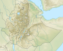
| Tsaliet | |
|---|---|
 The Tsaliet River near Dabba Selama monastery | |
Tsaliet River in Tigray Region | |
| Location | |
| Country | Ethiopia |
| Region | Tigray Region |
| Physical characteristics | |
| Source | Tegula'i |
| • location | Ayninbirkekin municipality |
| • elevation | 2,512 m (8,241 ft) |
| Mouth | Weri'i River |
• location | 10 km N of Werqamba |
• coordinates | 13°50′38″N 39°00′22″E / 13.844°N 39.006°E |
• elevation | 1,380 m (4,530 ft) |
| Length | 45 km (28 mi) |
| Width | |
| • average | 50 m (160 ft) |
| Basin features | |
| River system | Permanent river |
| Landmarks | Dabba Selama monastery, Arebay mountain, Haddinnet ridge, Welegesa rock church |
| Tributaries | |
| • left | Graliwdo, May Meqa, Kidane Mihret, Ferrey[1] |
| • right | Korowya, Agefet |
| Waterbodies | May Leiba reservoir, Kolu Ba’alti pond |
| Waterfalls | Tinsehe |
| Bridges | Addeha (road Werqamba-Hawzien); Ruba Weyni (rural road) |
| Topography | Mountains and deep gorges |
The Tsaliet is a river in northern Ethiopia, belonging to the Nile basin. Rising in the mountains of Dogu’a Tembien, where it is first called May Leiba River and then Tinsehe River, it flows westward through a deep gorge, to become Tsaliet in its lower course, where it empties in Weri’i River, just upstream of the main Weri’i bridge along the road to Adwa.[1]

- ^ a b Jacob, M. and colleagues (2019). Geo-trekking map of Dogu'a Tembien (1:50,000). In: Geo-trekking in Ethiopia's Tropical Mountains - The Dogu'a Tembien District. SpringerNature. ISBN 978-3-030-04954-6.
