Native name: 対馬 | |
|---|---|
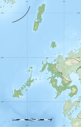
 Satellite photo of Tsushima island | |
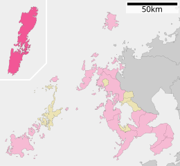
 Map of Nagasaki Prefecture with Tsushima Island in red | |
| Geography | |
| Location | Tsushima Strait, Korea Strait |
| Coordinates | 34°25′N 129°20′E / 34.417°N 129.333°E |
| Adjacent to | Tsushima Strait |
| Area | 708.7 km2 (273.6 sq mi)[1] |
| Coastline | 915 km (568.6 mi) |
| Highest elevation | 649 m (2129 ft) |
| Highest point | Mt. Yatate[2] |
| Administration | |
| Prefectures | Nagasaki Prefecture |
| City | Tsushima |
| Demographics | |
| Population | 28,502 (Dec 2022.) |
| Pop. density | 40/km2 (100/sq mi) |
| Ethnic groups | Japanese people |
Tsushima Island (Japanese: 対馬, Hepburn: Tsushima) is an island of the Japanese archipelago situated in-between the Tsushima Strait and Korea Strait, approximately halfway between Kyushu and the Korean Peninsula.[3][4] The main island of Tsushima, once a single island, was divided into two in 1671 by the Ōfunakoshiseto canal and into three in 1900 by the Manzekiseto canal. These canals were driven through isthmuses in the center of the island, forming "North Tsushima Island" (Kamino-shima) and "South Tsushima Island" (Shimono-shima). Tsushima also incorporates over 100 smaller islands, many tiny. The name Tsushima generally refers to all the islands of the Tsushima archipelago collectively.[5] Administratively, Tsushima Island is in Nagasaki Prefecture.
The island group measures about 70 km (43 mi) by 15 km (9 mi) and had a population of about 28,000 as of 2022[update]. The main islands (that is, the "North" and "South" islands, and the thin island that connects them) are the largest coherent satellite island group of Nagasaki Prefecture and the eighth-largest in Japan. The city of Tsushima, Nagasaki lies on Tsushima Island and is divided into six boroughs.[6]
- ^ 市勢要覧(資料編) Archived 12 December 2007 at the Wayback Machine (in Japanese)—Data about Tsushima
- ^ Cite error: The named reference
tsuhimamountainswas invoked but never defined (see the help page). - ^ "34.416667,129.333333 - Map of Cities in 34.416667,129.333333 - MapQuest". www.mapquest.com. Retrieved 20 August 2020.
- ^ "Tsushima | archipelago, Japan". Encyclopedia Britannica. Retrieved 20 August 2020.
- ^ For example:"Tsushima". The New Encyclopaedia Britannica: Macropaedia. Vol. 10 (15 ed.). Encyclopaedia Britannica. 1983. ISBN 9780852294000. Retrieved 28 October 2020.
Tsushima, archipelago, Nagasaki Prefecture (ken), Japan, in the Korea Strait separating Japan and Korea.
- ^ "A Profile of Tsushima shi (Tsushima City)". www.city.tsushima.nagasaki.jp. Archived from the original on 10 September 2020. Retrieved 20 August 2020.

