Tullibody
| |
|---|---|
 Residential area of Tullibody with the Ochils in the background | |
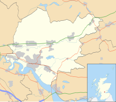
Location within Clackmannanshire | |
| Area | 3.03 sq mi (7.8 km2) |
| Population | 8,490 (2022)[1] |
| • Density | 2,802/sq mi (1,082/km2) |
| OS grid reference | NS859951 |
| Council area | |
| Lieutenancy area | |
| Country | Scotland |
| Sovereign state | United Kingdom |
| Post town | ALLOA |
| Postcode district | FK10 |
| Dialling code | 01259 |
| Police | Scotland |
| Fire | Scottish |
| Ambulance | Scottish |
| UK Parliament | |
| Scottish Parliament | |
Tullibody (Scottish Gaelic: Tulach Bòide) is a village set in the Central Lowlands of Scotland. It lies north of the River Forth near to the foot of the Ochil Hills within the Forth Valley. The village is 1.8 miles (2.9 km) south-west of Alva, 1.8 miles (2.9 km) north-west[2] of Alloa and 4.0 miles (6.4 km) east-northeast of Stirling. The village is part of the Clackmannanshire council area.
According to a 2012 estimate the population of Tullibody is approximately 8,710[3] or 9,530 residents including the area of Cambus.[4][5]
- ^ "Mid-2020 Population Estimates for Settlements and Localities in Scotland". National Records of Scotland. 31 March 2022. Retrieved 31 March 2022.
- ^ Beveridge, David (1888). Between the Ochils and Forth: A Description, Topographical and Historical of the Country between Stirling Bridge and Aberdour. Edinburgh and London: W. Blackwood. pp. 211–217. Retrieved 3 July 2017.
- ^ "Estimated population of localities by broad age groups, mid-2012" (PDF). Retrieved 3 January 2018.
- ^ Population of settlements, ClacksWeb Retrieved 2017-07-06.
- ^ Includes the area of Cambus
