| Tumbarumba New South Wales | |||||||||
|---|---|---|---|---|---|---|---|---|---|
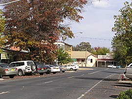
 The Parade, Main street of Tumbarumba | |||||||||
| Coordinates | 35°47′0″S 148°01′0″E / 35.78333°S 148.01667°E | ||||||||
| Population | 1,862 (2016 census)[1] | ||||||||
| Established | 1850s | ||||||||
| Postcode(s) | 2653 | ||||||||
| Elevation | 645 m (2,116 ft) | ||||||||
| Location |
| ||||||||
| LGA(s) | Snowy Valleys Council | ||||||||
| County | Selwyn | ||||||||
| State electorate(s) | Albury | ||||||||
| Federal division(s) | Eden-Monaro | ||||||||
| |||||||||
Tumbarumba (/tʌmbəˈrʌmbə/[2] tum-bə-RUM-bə) is a town in New South Wales, Australia, about 480 kilometres (300 mi) southwest of the state capital, Sydney. Tumbarumba is located on the periphery of the Riverina and South West Slopes regions at the western edge of the Snowy Mountains. The 2016 census showed the population of the town and surrounding area to be 1,862 people.[1] Locals refer to the town as 'Tumba'.
To the south and east, the highest peak of the Snowy Mountains and mainland Australia—Mount Kosciuszko—can be seen.
- ^ a b Australian Bureau of Statistics (27 June 2017). "Tumbarumba (state suburbs)". 2016 Census QuickStats. Retrieved 29 June 2017.
- ^ Butler, Susan, ed. (2009). Macquarie Dictionary (5th ed.). Sydney: Macquarie Dictionary Publishers Pty Ltd. 1952 pages. ISBN 978-1-876-42966-9. Archived from the original on 12 January 2014. Retrieved 7 June 2019.
