Tysnes Municipality
Tysnes kommune | |
|---|---|
 The harbour in Våge | |
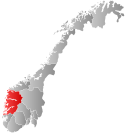
 Vestland within Norway | |
 Tysnes within Vestland | |
| Coordinates: 59°59′54″N 05°34′38″E / 59.99833°N 5.57722°E | |
| Country | Norway |
| County | Vestland |
| District | Sunnhordland |
| Established | 1 Jan 1838 |
| • Created as | Formannskapsdistrikt |
| Administrative centre | Uggdal |
| Government | |
| • Mayor (2023) | Synnøve Bakke (Ap) |
| Area | |
| • Total | 255.14 km2 (98.51 sq mi) |
| • Land | 245.19 km2 (94.67 sq mi) |
| • Water | 9.93 km2 (3.83 sq mi) 3.9% |
| • Rank | #283 in Norway |
| Population (2023) | |
| • Total | 2,910 |
| • Rank | #232 in Norway |
| • Density | 11.9/km2 (31/sq mi) |
| • Change (10 years) | |
| Demonym | Tysnesing[1] |
| Official language | |
| • Norwegian form | Nynorsk |
| Time zone | UTC+01:00 (CET) |
| • Summer (DST) | UTC+02:00 (CEST) |
| ISO 3166 code | NO-4616[3] |
| Website | Official website |
Tysnes (Urban East Norwegian: [ˈtŷːsneːs]) is a municipality in Vestland county, Norway. It is located in the traditional district of Sunnhordland. The administrative centre is the village of Uggdal. Other population centres in Tysnes include the villages of Våge and Onarheim. The island municipality is located in a group of islands near the mouth of the Hardangerfjorden. The majority of the municipal population lives on the island of Tysnesøya, the largest island in the municipality.[4]
The 255-square-kilometre (98 sq mi) municipality is the 283rd largest by area out of the 356 municipalities in Norway. Tysnes is the 232nd most populous municipality in Norway with a population of 2,910. The municipality's population density is 11.9 inhabitants per square kilometre (31/sq mi) and its population has increased by 6.4% over the previous 10-year period.[5][6]
- ^ "Navn på steder og personer: Innbyggjarnamn" (in Norwegian). Språkrådet.
- ^ "Forskrift om målvedtak i kommunar og fylkeskommunar" (in Norwegian). Lovdata.no.
- ^ Bolstad, Erik; Thorsnæs, Geir, eds. (26 January 2023). "Kommunenummer". Store norske leksikon (in Norwegian). Kunnskapsforlaget.
- ^ Store norske leksikon. "Tysnes" (in Norwegian). Retrieved 22 January 2015.
- ^ Statistisk sentralbyrå. "Table: 06913: Population 1 January and population changes during the calendar year (M)" (in Norwegian).
- ^ Statistisk sentralbyrå. "09280: Area of land and fresh water (km²) (M)" (in Norwegian).
