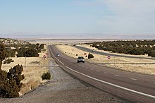
US 89 highlighted in red; former US 89T in blue | ||||
| Route information | ||||
| Maintained by ADOT | ||||
| Length | 136.49 mi[1] (219.66 km) | |||
| Existed | November 11, 1926–present | |||
| History | Southern terminus was in Nogales until 1992 | |||
| Major junctions | ||||
| South end | ||||
| North end | ||||
| Location | ||||
| Country | United States | |||
| State | Arizona | |||
| Counties | Coconino | |||
| Highway system | ||||
| ||||
| ||||


U.S. Route 89 (US 89) is a U.S. Highway in the U.S. state of Arizona that begins in Flagstaff and heads north to the Utah border northwest of Page. US 89 is among the first U.S. Highways established in Arizona between November 11, 1926 and September 9, 1927. Until 1992, US 89 started at the international border in Nogales and was routed through Tucson, Phoenix and Prescott between Nogales and Flagstaff. State Route 79 and State Route 89 are both former sections of US 89.
- ^ Arizona Department of Transportation. "2008 ADOT Highway Log" (PDF). Retrieved April 9, 2008.

