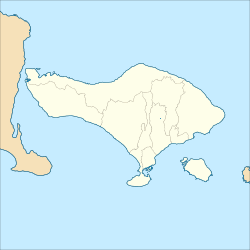
Ubud | |
|---|---|
| Other transcription(s) | |
| • Balinese | ᬳᬸᬩᬸᬤ᭄ (Hubut) |
 Monkey Forest Street in Ubud | |
| Coordinates: 8°30′24.75″S 115°15′44.49″E / 8.5068750°S 115.2623583°E | |
| Country | Indonesia |
| Province | Bali |
| Regency | Gianyar |
| Area | |
• Total | 42.38 km2 (16.36 sq mi) |
| Population (2020 Census) | |
• Total | 74,800 |
| • Density | 1,800/km2 (4,600/sq mi) |
| [1] | |
| Time zone | UTC+08 |


Ubud is a town on the Indonesian island of Bali in Ubud District, located amongst rice paddies and steep ravines in the central foothills of the Gianyar regency. Promoted as an arts and culture centre, it has developed a large tourism industry.[2] It forms a northern part of the Greater Denpasar metropolitan area (known as Sarbagita).
Ubud is an administrative district (kecamatan) with a population of 74,800 (as of the 2020 Census)[1] in an area of 42.38 km2. The central area of Ubud desa (village) has a population of 11,971 and an area of 6.76 km2,[3] and receives more than three million foreign tourists each year.[4] The area surrounding the town is made up of farms, rice paddies, agroforestry plantations, and tourist accommodations. As of 2018, more tourists visited Ubud than Denpasar to the south.[5]
- ^ a b Badan Pusat Statistik, Jakarta, 2021.
- ^ "How Ubud became the holistic heart of Asia". SBS. 2016-02-02. Retrieved December 31, 2018.
- ^ according to Kemendagri year-end of 2020 tabulation,
- ^ "2017, KUNJUNGAN WISATAWAN KE GIANYAR CAPAI 3,8 JUTA". Tribunnews. 2018-04-19. Retrieved December 31, 2018.
- ^ "Ternyata Wisatawan Lebih Banyak Berkunjung ke Ubud Dibandingkan Denpasar". Tribunnews. 2018-08-27. Retrieved December 31, 2018.
