| Ukkusiksalik National Park | |
|---|---|
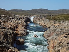
 Upper falls on Sila River | |
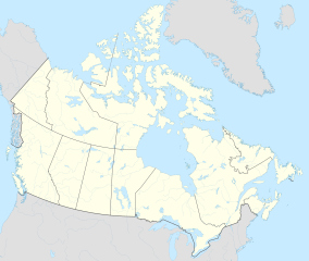
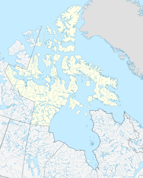
| Location | Nunavut, Canada |
| Nearest city | Chesterfield Inlet |
| Coordinates | 65°20′30″N 87°18′20″W / 65.34167°N 87.30556°W |
| Area | 20,885 km2 (8,064 sq mi) |
| Established | August 23, 2003 |
| Governing body | Parks Canada |
Ukkusiksalik National Park (/uːkuːˈsɪksəlɪk/)[1] is a national park in Nunavut, Canada. It covers 20,885 km2 (8,064 sq mi) of tundra and coastal mudflats south of the Arctic Circle and the hamlet of Naujaat (formerly Repulse Bay), from Hudson Bay's Roes Welcome Sound towards the western Barrenlands and the source of Brown River. The park surrounds Wager Bay, a 100 km (62 mi)-long inlet on the Hudson Bay. Although the smallest of Nunavut's four national parks, it is the sixth largest in Canada. Its name relates to steatite found there: Ukkusiksalik means "where there is material for the stone pot" (from ukkusik, meaning pot or saucepan like qulliq).
In addition to a reversing waterfall and over 500 archeological sites, including an old Hudson's Bay Company (HBC) trading post, the region is home to such species as polar bears, grizzly bears, Arctic wolf, barren-ground caribou, seals and peregrine falcons. Vegetation in the park is typical low tundra, with dwarf birch, willow and mountain avens. Scattered patches of boreal forest can be encountered in river valleys.
The park is uninhabited now, but the Inuit lived there from the 11th century to the 1960s. Remains of fox traps, tent rings, and food caches have been discovered in the area. The Hudson's Bay Company had an operating trading post in the area from 1925 to 1947.
The park was created on August 23, 2003, becoming Canada's 41st national park, and the fourth in Nunavut. It can be reached from the nearest communities of Baker Lake or Naujaat by plane or boat.
- ^ Parks Canada (2017-07-26). Parks Can Can Canada 2017. Archived from the original on 2021-12-12. Retrieved 2019-05-19.

