Union County | |
|---|---|
 Union County Courthouse in El Dorado | |
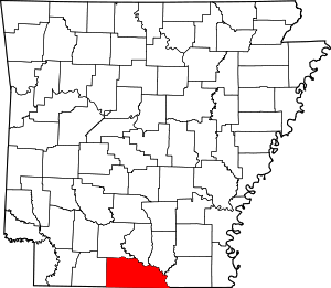
 Location within the U.S. state of Arkansas | |
 Arkansas's location within the U.S. | |
| Coordinates: 33°11′14″N 92°35′29″W / 33.187222222222°N 92.591388888889°W | |
| Country | |
| State | |
| Founded | November 2, 1829 |
| Seat | El Dorado |
| Largest city | El Dorado |
| Area | |
| • Total | 1,055 sq mi (2,730 km2) |
| • Land | 1,039 sq mi (2,690 km2) |
| • Water | 16 sq mi (40 km2) 1.5% |
| Population (2020) | |
| • Total | 39,054 |
| • Density | 40/sq mi (20/km2) |
| Time zone | UTC−6 (Central) |
| • Summer (DST) | UTC−5 (CDT) |
| Congressional district | 4th |
| Website | www |

Union County is a county located on the central southern border of the U.S. state of Arkansas. As of the 2020 census, the population was 39,054.[1] The county seat is El Dorado. The county was formed on November 2, 1829, and named in recognition of the citizens' petition for a new county, which said that they were petitioning "in the spirit of Union and Unity." The county is directly adjacent to the south to Union Parish in the state of Louisiana.
The El Dorado, AR Micropolitan Statistical Area includes all of Union County.
Called by boosters the "Queen City of South Arkansas", El Dorado was at the heart of the 1920s oil boom in South Arkansas. More recently, the city has been called "Arkansas's Original Boomtown," as it emphasizes its historic assets for heritage tourism.[2] The chemical and timber industries became important during and after World War II, and still have a place in the economy.
- ^ "Census - Geography Profile: Union County, Arkansas". United States Census Bureau. Retrieved January 21, 2023.
- ^ Bridges, Kenneth. "El Dorado (Union County)". Encyclopedia of Arkansas. Retrieved June 2, 2015.