| Upper Angara | |
|---|---|
 View from the BAM railway bridge across the Upper Angara near Novy Uoyan | |
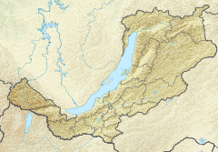
Mouth location in Buryatia, Russia | |
| Location | |
| Country | Russia |
| Physical characteristics | |
| Source | Delyun-Uran Range Stanovoy Highlands |
| • coordinates | 56°36′51″N 113°45′21″E / 56.61417°N 113.75583°E |
| • elevation | 1,600 m (5,200 ft) |
| Mouth | Lake Baikal |
• coordinates | 55°42′24″N 109°52′33″E / 55.70667°N 109.87583°E |
| Length | 438 km (272 mi) |
| Basin size | 21,400 km2 (8,300 sq mi) |
| Discharge | |
| • average | 258 m3/s (9,100 cu ft/s) |
| Basin features | |
| Progression | Lake Baikal→ Angara→ Yenisey→ Kara Sea |
The Upper Angara (Russian: Верхняя Ангара, Verkhnyaya Angara; Buryat: Дээдэ Ангар, Deede Angar) is a river in Buryatia, Siberia to the northeast of Lake Baikal. the third longest river in the Baikal basin. It is 438 kilometres (272 mi) long, and has a drainage basin of 21,400 square kilometres (8,300 sq mi).[1]
The Baikal–Amur Mainline runs along the north side of the river northeast up its valley, crossing between Anamakit and Novy Uoyan and crossing the river a second time upstream before heading into the mountains.[2]
- ^ "Река Верхняя Ангара in the State Water Register of Russia". textual.ru (in Russian). (Upper Angara River)
- ^ Wikimapia approximate site of basin
