| UNESCO World Heritage Site | |
|---|---|
 | |
| Location | Upper Harz, Lower Saxony, Germany |
| Part of | Mines of Rammelsberg, Historic Town of Goslar and Upper Harz Water Management System |
| Includes | |
| Criteria | Cultural: (i)(ii)(iii)(iv) |
| Reference | 623ter-002 |
| Inscription | 1992 (16th Session) |
| Extensions | 2008, 2010 |
| Area | 1,009.89 ha (2,495.5 acres) |
| Buffer zone | 5,654.69 ha (13,973.0 acres) |
| Coordinates | 51°49′12″N 10°20′24″E / 51.82000°N 10.34000°E |
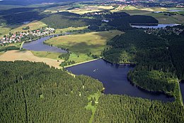
The Upper Harz Water Regale (‹See Tfd›German: Oberharzer Wasserregal, pronounced [ˌoːbɐhaːɐ̯tsɐ ˈvasɐʁeɡaːl]) is a system of dams, reservoirs, ditches and other structures, much of which was built from the 16th to 19th centuries to divert and store the water that drove the water wheels of the mines in the Upper Harz region of Germany. The term regale, here, refers to the granting of royal privileges or rights[1] (droit de régale) in this case to permit the use of water for mining operations in the Harz mountains of Germany.
The Upper Harz Water Regale is one of the largest and most important historic mining water management systems in the world.[2] The facilities developed for the generation of water power have been placed under protection since 1978 as cultural monuments.[2] The majority are still used, albeit nowadays their purpose is primarily to support rural conservation (the preservation of a historic cultural landscape), nature conservation, tourism and swimming. From a water management perspective, several of the reservoirs still play a role in flood protection and the supply of drinking water. On 31 July 2010 the Regale was declared a UNESCO World Heritage Site affiliated with the Mines of Rammelsberg and the Historic Town of Goslar because of its importance in the development of mining techniques and testimony to the medieval history of ore mining.[3][4]
The water system covers an area of roughly 200 square kilometres (77 sq mi) within the Lower Saxon part of the Harz, the majority of structures being found in the vicinity of Clausthal-Zellerfeld, Hahnenklee, Sankt Andreasberg, Buntenbock, Wildemann, Lautenthal, Schulenberg, Altenau and Torfhaus.
- ^ Langenscheidt's Muret-Sanders German-English dictionary (Berlin, 2004) gives one translation of the German word Regal as "regale", a legal and historical term.
- ^ a b Cite error: The named reference
Haasewas invoked but never defined (see the help page). - ^ Oberharzer Wasserregal zum Weltkulturerbe ernannt tagesschau.de, accessed on 1 August 2010
- ^ "Mines of Rammelsberg, Historic Town of Goslar and Upper Harz Water Management System". UNESCO World Heritage Centre. United Nations Educational, Scientific, and Cultural Organization. Retrieved 25 Jun 2022.

