Urlings | |
|---|---|
Village | |
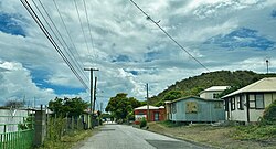
 Urlings in June 2023 | |
 | |
| Coordinates: 17°1′29″N 61°52′22″W / 17.02472°N 61.87278°W | |
| Country | Antigua and Barbuda |
| Island | Antigua |
| Civil parish | Saint Mary |
| Government | |
| • Member of Parliament | Kelvin Simon |
| Area | |
| • Total | 1.0 km2 (0.39 sq mi) |
| Elevation | 50 m (160 ft) |
| Population | |
| • Total | 738 |
| • Density | 753/km2 (1,951/sq mi) |
| Demonym | Urlingsian |
| Time zone | UTC-4 (AST) |
| Airport | V.C. Bird International Airport, in another town, 15.57 km |
| Constituency | St. Mary's South |
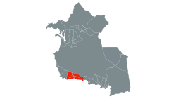
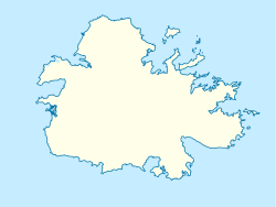
| Location |
|
Urlings[A] is a village in Saint Mary, and the twenty-sixth largest settlement in Antigua and Barbuda. Urlings is located in the southwest of Antigua[1] and has a history dating to before 1856.[2] Urlings started as a small coastal village with a little over 100 people in the 1800s to now being one of the country's more medium sized towns.[2] Urlings is separated from the rest of Antigua by the Shekerley Mountains. Urlings is located between the communities of Johnsons Point and Old Road.[3] Urlings has a seafood festival,[4] a community association,[5] a primary school,[6] a playing field,[7] a fisheries complex,[8] and a cricket club that plays in the Village Parish League.[9][10]
Cite error: There are <ref group=upper-alpha> tags or {{efn-ua}} templates on this page, but the references will not show without a {{reflist|group=upper-alpha}} template or {{notelist-ua}} template (see the help page).
- ^ Cite error: The named reference
:1was invoked but never defined (see the help page). - ^ a b Cite error: The named reference
:2was invoked but never defined (see the help page). - ^ Cite error: The named reference
:0was invoked but never defined (see the help page). - ^ "Urlings Seafood Fest". agriculture.gov.ag.
- ^ "Registration". Facebook. Retrieved 2023-04-11.
- ^ "Government primary school enrollment 2009 to 2018 - Antigua and Barbuda". statistics.gov.ag.
- ^ https://nri.environment.gov.ag/geoserver/ows?service=WFS&version=1.0.0&request=GetFeature&typename=geonode%3ASOC_ATG_RecreationFacilities_2020_84&outputFormat=gml2&srs=EPSG%3A32620 [bare URL]
- ^ Cite error: The named reference
:3was invoked but never defined (see the help page). - ^ "Urlings Cricket Club - Antigua". International Cricket Tours. Retrieved 2023-09-30.
- ^ "Urlings Cricket Club". Cricket268. 2023-05-27. Retrieved 2023-09-30.
