| Uvs Lake | |
|---|---|
 | |
| Coordinates | 50°18′N 92°42′E / 50.300°N 92.700°E |
| Type | Saline |
| Primary inflows | Tesiin gol、Kharkhiraa River、Turuun River |
| Primary outflows | none |
| Basin countries | Mongolia and Russia |
| Max. length | 84 km (52 mi) |
| Max. width | 79 km (49 mi) |
| Surface area | 3,350 km2 (1,290 sq mi) |
| Average depth | 6 m (20 ft) |
| Surface elevation | 759 m (2,490 ft) |
| Settlements | Ulaangom |
| Official name | Lake Uvs and its surrounding wetlands |
| Designated | 22 March 2004 |
| Reference no. | 1379[1] |
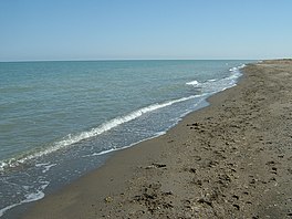
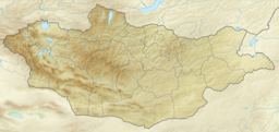
Uvs Lake (Mongolian: Увс нуур [ˌʊɸs‿ˈnʊːr]) is a highly saline lake in an endorheic basin—Uvs Nuur Basin, primarily in Mongolia with a smaller part in Russia. It is the largest lake in Mongolia by surface area, covering 3,350 km2 at 759 m above sea level.[2] The northeastern tip of the lake is situated in the Tuva Republic of the Russian Federation. The largest settlement near the lake is Ulaangom. This shallow and very saline body of water is a remainder of a huge saline sea which covered a much larger area several thousand years ago.
- ^ "Lake Uvs and its surrounding wetlands". Ramsar Sites Information Service. Retrieved 25 April 2018.
- ^ "Увс нуур". www.medeelel.mn. Archived from the original on 2012-08-04. Retrieved 2008-02-08.
