Valenton | |
|---|---|
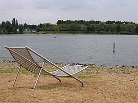
 Plage Bleue park | |
 Paris and inner ring departments | |
| Coordinates: 48°44′42″N 2°28′02″E / 48.745°N 2.4672°E | |
| Country | France |
| Region | Île-de-France |
| Department | Val-de-Marne |
| Arrondissement | L'Haÿ-les-Roses |
| Canton | Villeneuve-Saint-Georges |
| Intercommunality | Grand Paris |
| Government | |
| • Mayor (2020–2026) | Métin Yavuz[1] |
Area 1 | 5.31 km2 (2.05 sq mi) |
| Population (2021)[2] | 14,482 |
| • Density | 2,700/km2 (7,100/sq mi) |
| Time zone | UTC+01:00 (CET) |
| • Summer (DST) | UTC+02:00 (CEST) |
| INSEE/Postal code | 94074 /94460 |
| Elevation | 32–87 m (105–285 ft) |
| 1 French Land Register data, which excludes lakes, ponds, glaciers > 1 km2 (0.386 sq mi or 247 acres) and river estuaries. | |
Valenton (French pronunciation: [valɑ̃tɔ̃] ) is a commune in the southeastern suburbs of Paris, France. It is located 15.1 km (9.4 mi) from the center of Paris. It extends over 531 hectares (1,310 acres) of which 84 hectares (210 acres) are green spaces. The most important public green space is the Plage Bleue Park where different events are organized every year. Among them, we have the Festival de l’Oh focused on environmental issues dealing with aquatic resources. Valenton is surrounded by the towns of Choisy-le-Roi, Créteil, Crosne, Limeil-Brévannes, Villeneuve-Saint-Georges and Yerres. The town can be reached through the motorway A86 and the main road RN6. It is connected to the suburban rail network with the RER line D (Villeneuve Triage and Villeneuve-Saint-Georges, the two closest stations) or RER line A at Boissy-Saint-Léger.
- ^ "Répertoire national des élus: les maires". data.gouv.fr, Plateforme ouverte des données publiques françaises (in French). 2 December 2020.
- ^ "Populations légales 2021" (in French). The National Institute of Statistics and Economic Studies. 28 December 2023.


