This article needs additional citations for verification. (July 2012) |
Varosha
| |
|---|---|
 Varosha in 2006 | |
| Coordinates: 35°06′39″N 33°57′13″E / 35.11083°N 33.95361°E | |
| Country (de jure) | |
| • District | Famagusta District |
| Country (de facto) | |
| • District | Gazimağusa District |
| Population (2011) | |
| • Total | 226 (Census of Northern Cyprus) 39,000 (at peak) |


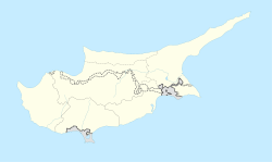
Varosha (Greek: Βαρώσια, romanized: Varósia, locally [vaˈɾoʃa]; Turkish: Maraş [maˈɾaʃ] or Kapalı Maraş[2][3]) is the southern quarter of Famagusta, a de jure territory of Cyprus, currently under the control of Northern Cyprus. Varosha has a population of 226 in the 2011 Northern Cyprus census.[4] The area of Varosha is 6.19 km2 (2.39 sq mi).[5]
- ^ In 1983, the Turkish Republic of Northern Cyprus unilaterally declared independence from the Republic of Cyprus. The de facto state is not recognised by any UN state except Turkey.
- ^ Uğur Dağlı; Şehir Plancısı Naciye Doratlı; Şebnem Önal (1998). "Gazimağusa Şehrinin Kentsel Gelişiminin Sürdürülebilirliğine Yönelik Çözüm Önerileri" (in Turkish). Doğu Akdeniz Üniversitesi, Mimarlık Fakültesi. Retrieved 21 November 2012.
{{cite journal}}: Cite journal requires|journal=(help)[permanent dead link] - ^ Doratlı, Naciye; İbrahim Numan; Özgür Dinçyürek (2002). "GAZİMAĞUSA'NIN FARKLI SENARYOLARA GÖRE DEĞİŞİMİNİN MORFOLOJİK AÇIDAN İRDELENMESİ" (in Turkish). DAÜ Mimarlık Fakültesi, KKTC. Retrieved 21 November 2012.
{{cite journal}}: Cite journal requires|journal=(help)[permanent dead link] - ^ "Northern Cyprus, State Planning Organization, The results of census of Northern Cyprus - 2011". Northern Cyprus, State Planning Organization. Retrieved 25 March 2020.
- ^ ""Varosha is the land of Evkaf (the Turkish Cypriot EVKAF religious foundation)"". Haber7 (in Turkish). October 8, 2020.
