| Ventura River | |
|---|---|
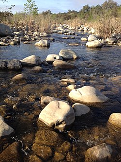
 Ventura River flowing through cobble near Meiners Oaks. | |
 | |
| Location | |
| Country | United States |
| State | California |
| Physical characteristics | |
| Source | Transverse Ranges |
| • location | Confluence of Matilija Creek and North Fork Matilija Creek, near Ojai |
| • coordinates | 34°29′07″N 119°18′02″W / 34.48528°N 119.30056°W[3] |
| • elevation | 6,010 ft (1,830 m) |
| Mouth | Pacific Ocean |
• location | Ventura River Estuary, near Ventura |
• coordinates | 34°16′32″N 119°18′28″W / 34.27556°N 119.30778°W[3] |
• elevation | 0 ft (0 m) |
| Length | 16.2 mi (26.1 km) |
| Basin size | 226 sq mi (590 km2)[4] |
| Discharge | |
| • location | near Ventura[1] |
| • average | 72.6 cu ft/s (2.06 m3/s)[2] |
| • minimum | 0 cu ft/s (0 m3/s) |
| • maximum | 63,600 cu ft/s (1,800 m3/s) |
| Basin features | |
| Tributaries | |
| • left | San Antonio Creek, Cañada Larga Creek |
| • right | Matilija Creek, North Fork Matilija Creek, Coyote Creek |
The Ventura River, in western Ventura County in southern California, United States, flows 16.2 miles (26.1 km) from its headwaters to the Pacific Ocean. The smallest of the three major rivers in Ventura County, it flows through the steeply sloped, narrow Ventura Valley, with its final 0.7 miles (1.1 km) through the broader Ventura River estuary, which extends from where it crosses under a 101 Freeway bridge through to the Pacific Ocean.[4]
- ^ "USGS Gage #11118501 Ventura River and Ventura City Diversion near Ventura, CA" (PDF). National Water Information System. U.S. Geological Survey. 1933–2007. Retrieved January 19, 2014.
- ^ "USGS Gage #11118501 Ventura River and Ventura City Diversion near Ventura, CA" (PDF). National Water Information System. U.S. Geological Survey. 1933–2007. Retrieved January 19, 2014.
- ^ a b "Ventura River". Geographic Names Information System. United States Geological Survey, United States Department of the Interior. January 19, 1981. Retrieved January 19, 2014.
- ^ a b "The Ventura River Watershed Management Plan". Ventura River Watershed Council. Retrieved June 15, 2015.