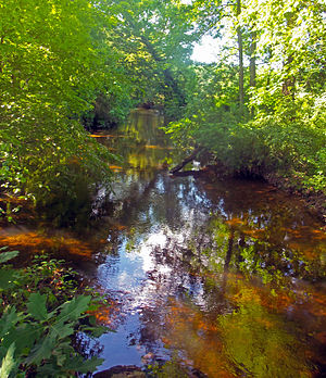
| Verkeerder Kill | |
|---|---|
 Verkeerder Kill at Verkeerder Kill Park | |
 | |
| Etymology | Dutch for "wrong brook" |
| Location | |
| Country | United States |
| State | New York |
| Region | Hudson Valley |
| County | Ulster |
| Towns | Wawarsing, Shawangunk |
| Physical characteristics | |
| Source | Unnamed location on Shawangunk Ridge |
| • location | Wawarsing |
| • coordinates | 41°41′41″N 74°19′39″W / 41.69472°N 74.32750°W |
| • elevation | 2,060 ft (630 m) |
| Mouth | Shawangunk Kill |
• location | SW of Pine Bush |
• coordinates | 41°36′7″N 74°19′33″W / 41.60194°N 74.32583°W |
• elevation | 333 ft (101 m) |
| Length | 8 mi (13 km), North-south |
The Verkeerder Kill, sometimes Verkeerderkill and locally shortened to Kaidy Kill[1] is an 8-mile-long (13 km)[2] stream in Ulster County, New York, United States. It rises on the Shawangunk Ridge, in the town of Wawarsing, and flows southwards through the town of Shawangunk, toward the Shawangunk Kill, itself a major tributary of the Wallkill River. Ultimately it is a part of the Hudson River's watershed.
It is best known for Verkeerder Kill Falls, a 187-foot (57 m) waterfall located on its headwaters just below its source, on the border between the two towns. The falls are a popular hiking destination along the Long Path, a long-distance hiking trail from New York City to the Capital District that traverses the area.
- ^ Fried, Marc B. (2005). Shawangunk Place-Names. Gardiner, NY: Marc B. Fried. pp. 88–91. ISBN 9780966335125.
- ^ "Stream Trace Summary Report". United States Geological Survey. February 2, 2016. Retrieved February 2, 2016.