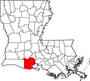
Vermilion Parish | |
|---|---|
 Museum at Gueydan, Louisiana | |
 Location within the U.S. state of Louisiana | |
 Louisiana's location within the U.S. | |
| Coordinates: 29°49′N 92°19′W / 29.81°N 92.31°W | |
| Country | |
| State | |
| Founded | 1844 |
| Named for | Vermilion River and Bay |
| Seat | Abbeville |
| Largest city | Abbeville |
| Area | |
| • Total | 1,542 sq mi (3,990 km2) |
| • Land | 1,173 sq mi (3,040 km2) |
| • Water | 369 sq mi (960 km2) 24% |
| Population (2020) | |
| • Total | 57,359 |
| • Density | 37/sq mi (14/km2) |
| Time zone | UTC−6 (Central) |
| • Summer (DST) | UTC−5 (CDT) |
| Congressional district | 3rd |
Vermilion Parish (French: Paroisse de Vermillion) is a parish located in the U.S. state of Louisiana, created in 1844.[1] The parish seat is Abbeville.[2] Vermilion Parish is part of the Lafayette metropolitan statistical area, and located in southern Acadiana. At the 2020 U.S. census, the population was 57,359.[3]
In the past several decades, much of the southern portion of the parish has been swept away by water erosion, especially after Hurricane Katrina and Hurricane Rita in 2005.
- ^ "Vermilion Parish". Center for Cultural and Eco-Tourism. Retrieved September 5, 2014.
- ^ "Find a County". National Association of Counties. Archived from the original on May 31, 2011. Retrieved June 7, 2011.
- ^ "Census - Geography Profile: Vermillion Parish, Louisiana". United States Census Bureau. Retrieved January 22, 2023.