Victoria Street, East Sydney | |
|---|---|
 | |
| St Vincent's College, Potts Point | |
 | |
| Coordinates |
|
| General information | |
| Type | Street |
| Length | 1.6 km (1.0 mi) |
| Major junctions | |
| Northern end | Grantham Street Potts Point, Sydney |
| |
| Southern end | Oxford Street Darlinghurst, Sydney |
| Location(s) | |
| LGA(s) | City of Sydney |
| Major suburbs | Potts Point, Darlinghurst |
| ---- | |
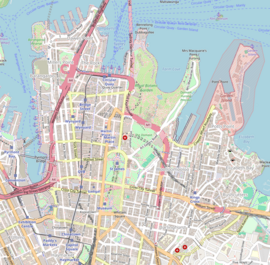
Victoria Street is a suburban street located in the inner eastern suburbs of Sydney, in the City of Sydney local government area of New South Wales, Australia. From south to north, Victoria Street goes through the suburbs of Darlinghurst, Potts Point and the locality of Kings Cross. It is 1.6 kilometres (0.99 mi) in length.[1] In the section in Darlinghurst, the street is one-way, from north to south only.
Redevelopment of the street during the early 1970s caused much controversy. Residents opposed the building of a forty-five storey complex and insisted that provision be made for middle and low income wage earners to remain living there. In response the NSW Builders Labourers Federation placed a green ban in 1971, bringing demolitions to a halt.[2] To prevent work being done by non-union labour, squatters moved into disused houses after residents were forced out. In January 1974 a confrontation occurred and all residents (except one, Mick Fowler) were evicted from the street. After continued campaigning the redevelopment design was amended and while low-cost housing was lost, some protection was applied to houses on the basis of heritage values.[3]
- ^ Map 4, Gregory's Street Directory, 2002 (Gregory's Pub. Co.)
- ^ Green Bans Art Walks Project (23 June 2023). "Green Bans Timeline: 1971-74". The Commons Social Change Library. Retrieved 9 July 2023.
- ^ McIntyre, Iain (31 August 2020). "Resources About Australian Housing Justice and Unwaged Rights Campaigns". The Commons Social Change Library. Retrieved 9 July 2023.
