Vielha e Mijaran | |
|---|---|
 | |
 Location in Aran | |
| Coordinates: 42°42′15″N 0°47′46″E / 42.70417°N 0.79611°E | |
| Country | |
| Autonomous Community | |
| Region | Aran |
| Terçons | Castièro, Marcatosa |
| Province | Lleida |
| Government | |
| • Mayor | Juan Antonio Serrano Iglesias (2015)[1] (UA) |
| Area | |
| • Total | 211.7 km2 (81.7 sq mi) |
| Elevation | 980 m (3,220 ft) |
| Population (2018)[3] | |
| • Total | 5,493 |
| • Density | 26/km2 (67/sq mi) |
| Postal code | 25530 |
| Climate | Cfb |
| Website | vielha-mijaran |
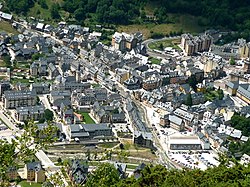
Vielha e Mijaran (Occitan pronunciation: [ˈbjeʎa e miʒaˈɾan]) is a municipality in central Aran, Catalonia, Spain. It is the capital and largest municipality of the region, with 5,581 inhabitants as of 2022.[4] It is part of the terçons of Castièro and Marcatosa.
It was created in 1970 by the merger of the municipalities of Arròs e Vila, Betlan, Escunhau, Gausac, Vielha and Vilac as Viella – Mitg-Aran: some of the former municipalities retain some privileges as "decentralised municipal entities" (entitats municipals descentralitzades, EMD),[5] as does the village of Betren. Mijaran literally means "Middle Aran" in Aranese, as the inhabited part of the municipality is situated in the valley of the Garonne (Garona). The Noguera Ribagorçana has its source on the territory of the municipality, on the opposite side of the watershed. The ajuntament (town hall) is in Vielha, spelled Vielha in Occitan and Viella in Catalan and Spanish, which is also the capital of Aran and also the seat of the Conselh Generau d'Aran.
The municipality is linked to France and to the rest of Catalonia (via the Vielha tunnel) by the N-230 road. The C-28 (old name: C-142) road continues up the valley to Naut Aran, and on over the Port de la Bonaigua (2,072 m, 6,798 ft) to the comarca of Pallars Sobirà. This road, the higher stretches of which are impassable in winter, was the only route between the Aran valley and the rest of Spain before the opening of the Vielha tunnel in 1948.
- ^ "Vielha Mijaran :: Eth Baile". www.vielha-mijaran.org. Retrieved 2023-10-28.
- ^ "El municipi en xifres: Vielha e Mijaran". Statistical Institute of Catalonia. Retrieved 2015-11-23.
- ^ Municipal Register of Spain 2018. National Statistics Institute.
- ^ "Idescat. The municipality in figures". www.idescat.cat. Retrieved 2023-10-28.
- ^ Entitats municipals descentralitzades are governed by the Llei Municipal i de Règim Local de Catalunya (8/1987 de 15 d'abril de 1987). They correspond to entidades locales menores in the rest of Spain (known as entitats locals menors in the Valencian Community and the Balearic Islands).


