This article needs additional citations for verification. (May 2020) |
Vientiane province
ແຂວງວຽງຈັນ | |
|---|---|
 | |
 Map of Vientiane province | |
 Location of Vientiane province in Laos | |
| Coordinates: 18°38′34″N 102°19′25″E / 18.64278°N 102.32361°E | |
| Country | Laos |
| Established | 1989 |
| Capital | Muang Phôn-Hông |
| Area | |
• Total | 15,610 km2 (6,030 sq mi) |
| Population (2020 census) | |
• Total | 462,142 |
| • Density | 30/km2 (77/sq mi) |
| Time zone | UTC+7 (ICT) |
| ISO 3166 code | LA-VI |
| HDI (2018) | medium · 3rd |
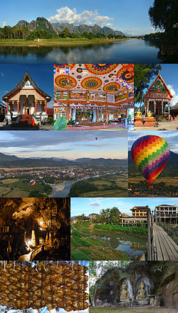
Vientiane province (Lao: ແຂວງວຽງຈັນ, pronounced [kʰwɛ̌ːŋ wíaŋ tɕàn]) is a province of Laos in the country's northwest. As of 2015 the province had a population of 419,090.[2] Vientiane province covers an area of 15,610 square kilometres (6,030 sq mi) composed of 11 districts. The principal towns are Vang Vieng and Muang Phôn-Hông.
In the mid-16th century, Vientiane, under King Setthathirat's rule, became prosperous. It became a major centre of Buddhist teachings and many temples were built.[3] In 1989, the province was split into two halves: Vientiane prefecture containing the city Vientiane itself, and the remainder of the province.
- ^ "Sub-national HDI". Global Data Lab. Archived from the original on 27 September 2020. Retrieved 13 September 2018.
- ^ "Results of Population and Housing Census 2015" (PDF). Lao Statistics Bureau. Archived (PDF) from the original on 8 March 2021. Retrieved 7 November 2020.
- ^ "History of Vientiane Province". Lonely Planet. Archived from the original on 22 July 2015. Retrieved 30 November 2012.