Virolahti
Vederlax | |
|---|---|
Municipality | |
| Virolahden kunta Vederlax kommun | |
 | |
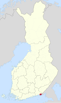
 Location of Virolahti in Finland | |
| Coordinates: 60°35′N 027°42′E / 60.583°N 27.700°E | |
| Country | |
| Region | Kymenlaakso |
| Sub-region | Kotka–Hamina sub-region |
| Government | |
| • Municipality manager | Veli-Matti Pulli |
| Area (2018-01-01)[1] | |
• Total | 558.92 km2 (215.80 sq mi) |
| • Land | 372.47 km2 (143.81 sq mi) |
| • Water | 186.97 km2 (72.19 sq mi) |
| • Rank | 208th largest in Finland |
| Population (2024-08-31)[2] | |
• Total | 2,886 |
| • Rank | 220th largest in Finland |
| • Density | 7.75/km2 (20.1/sq mi) |
| Population by native language | |
| • Finnish | 92.7% (official) |
| • Swedish | 0.4% |
| • Others | 6.9% |
| Population by age | |
| • 0 to 14 | 11.7% |
| • 15 to 64 | 55.3% |
| • 65 or older | 33% |
| Time zone | UTC+02:00 (EET) |
| • Summer (DST) | UTC+03:00 (EEST) |
| Climate | Dfb |
| Website | www.virolahti.fi |
Virolahti (Finnish: [ˈʋiroˌlɑhti]; Swedish: Vederlax) is the southeasternmost municipality of Finland on the border of Russia. It is located in the Kymenlaakso region. The municipality has a population of 2,886 (31 August 2024)[2] and covers an area of 558.92 square kilometres (215.80 sq mi), of which 186.97 km2 (72.19 sq mi) is water.[1] The population density is 7.75 inhabitants per square kilometre (20.1/sq mi).
The municipality is unilingually Finnish.

The Vaalimaa border crossing, which connects the municipality with Russia, is located in Virolahti.
- ^ a b "Area of Finnish Municipalities 1.1.2018" (PDF). National Land Survey of Finland. Retrieved 30 January 2018.
- ^ a b "Finland's preliminary population figure was 5,625,011 at the end of August 2024". Population structure. Statistics Finland. 2024-09-24. ISSN 1797-5395. Retrieved 2024-09-25.
- ^ "Population growth biggest in nearly 70 years". Population structure. Statistics Finland. 2024-04-26. ISSN 1797-5395. Retrieved 2024-04-29.
- ^ "Population according to age (1-year) and sex by area and the regional division of each statistical reference year, 2003–2020". StatFin. Statistics Finland. Retrieved 2 May 2021.
- ^ a b "Luettelo kuntien ja seurakuntien tuloveroprosenteista vuonna 2023". Tax Administration of Finland. 14 November 2022. Retrieved 7 May 2023.
