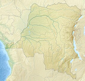
| Virunga National Park | |
|---|---|
| French: Parc National des Virunga | |
 | |
| Location | Democratic Republic of the Congo |
| Nearest city | Goma |
| Coordinates | 0°55′S 29°10′E / 0.917°S 29.167°E |
| Area | 7,768.93 km2 (2,999.60 sq mi)[1] |
| Established | April 1925 |
| Governing body | Institut Congolais pour la Conservation de la Nature[2] |
| Website | virunga |
| Criteria | Natural: (vii), (viii), (x) |
| Reference | 63 |
| Inscription | 1979 (3rd Session) |
| Endangered | 1994–... |
| Official name | Parc National des Virunga |
| Designated | 18 January 1996 |
| Reference no. | 787[3] |
Virunga National Park is a national park in the Albertine Rift Valley in the eastern part of the Democratic Republic of the Congo. It was created in 1925. In elevation, it ranges from 680 m (2,230 ft) in the Semliki River valley to 5,109 m (16,762 ft) in the Rwenzori Mountains. From north to south it extends approximately 300 km (190 mi), largely along the international borders with Uganda and Rwanda in the east.[2] It covers an area of 8,090 km2 (3,120 sq mi).
Two active volcanoes, Mount Nyiragongo and Nyamuragira, are located in the park.[4] They have significantly shaped the national park's diverse habitats and wildlife. More than 3,000 faunal and floral species have been recorded, of which more than 300 are endemic to the Albertine Rift including eastern gorilla (Gorilla beringei) and golden monkey (Cercopithecus kandti).[5] The park is also home to Tchegera Island.
In 1979, the national park was listed as a UNESCO World Heritage Site because of its rich diversity of habitats, exceptional biodiversity and endemism, and its protection of rare mountain gorilla habitat.[6] It has been listed in the List of World Heritage in Danger since 1994 because of civil unrest and increased human presence in the region.[7]
There have been several deadly attacks in the park by rebel groups, and several park rangers have been killed.[8][9]
- ^ a b World Database on Protected Areas (2018). "Virunga National Park". Protected Planet, United Nations Environment World Conservation Monitoring Centre. Retrieved 17 December 2019.
- ^ a b Crawford, A. & Bernstein, J. (2008). MEAs, Conservation and Conflict – A case study of Virunga National Park, DRC. Geneva: International Institute for Sustainable Development.
- ^ Secrétariat Général à l'Environnement et Conservation de la Nature (1994). "Parc national des Virunga". Ramsar Sites Information Service. Retrieved 25 April 2018.
- ^ Tedesco, D. (2002). "1995 Nyiragongo and Nyamulagira activity in the Virunga National Park: A volcanic crisis". Acta Vulcanologica. 14 (1/2): 149–155.
- ^ Plumptre, A. J.; Davenport, T. R.; Behangana, M.; Kityo, R.; Eilu, G.; Ssegawa, P.; Ewango, C.; Meirte, D.; Kahindo, C.; Herremans, M. & Peterhans, J. K. (2007). "The biodiversity of the Albertine Rift". Biological Conservation. 134 (2): 178–194. doi:10.1016/j.biocon.2006.08.021.
- ^ "Virunga National Park". UNESCO World Heritage Centre. United Nations Educational, Scientific, and Cultural Organization.
- ^ Debonnet, G. & Hillman-Smith, K. (2004). "Supporting protected areas in a time of political turmoil: the case of World Heritage Sites in the Democratic Republic of Congo". Parks. 14 (1): 9–16.
- ^ Actman, J. (2018). "Virunga National Park Sees Its Worst Violence in a Decade, Director Says". National Geographic News. Archived from the original on May 18, 2020. Retrieved 27 April 2020.
- ^ "Twelve rangers killed in latest Virunga Park incident". Mongabay Environmental News. 2020. Retrieved 27 April 2020.
