This article needs additional citations for verification. (March 2021) |
Visakhapatnam Airport | |||||||||||||||
|---|---|---|---|---|---|---|---|---|---|---|---|---|---|---|---|
 | |||||||||||||||
| Summary | |||||||||||||||
| Airport type | Military/Public | ||||||||||||||
| Owner | Indian Navy | ||||||||||||||
| Operator | |||||||||||||||
| Serves | Visakhapatnam | ||||||||||||||
| Location | Visakhapatnam, Andhra Pradesh, India | ||||||||||||||
| Elevation AMSL | 3 m / 10 ft | ||||||||||||||
| Coordinates | 17°43′16″N 083°13′28″E / 17.72111°N 83.22444°E | ||||||||||||||
| Website | Vishakhapatnam Airport | ||||||||||||||
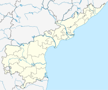
| Map | |||||||||||||||
| Runways | |||||||||||||||
| |||||||||||||||
| Statistics (April 2023 - March 2024) | |||||||||||||||
| |||||||||||||||
Visakhapatnam Airport[5] (IATA: VTZ, ICAO: VOVZ) is a customs airport in Visakhapatnam, Andhra Pradesh, India. It also operates as a civil enclave on an Indian Navy airbase named INS Dega. It lies between the city localities of NAD X Road and Gajuwaka. The airport covers an area of 350 acres. The airport has experienced significant growth since the beginning of the 21st century, with the construction of a new terminal and runway and the commencing of international flights.
- ^ "Visakhapatnam Airport".
- ^ "Annexure III – Passenger Data" (PDF). aai.aero. Retrieved 21 April 2024.
- ^ "Annexure II – Aircraft Movement Data" (PDF). aai.aero. Retrieved 21 April 2024.
- ^ "Annexure IV – Freight Movement Data" (PDF). aai.aero. Retrieved 21 April 2024.
- ^ "Visakhapatnam Airport". Airports Authority of India. Retrieved 22 June 2022.


