Vitla
Vitla, Vittal | |
|---|---|
Pattana Panchayath | |
| Vittal | |
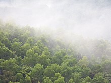
   Top to Bottom:Vitla Shri Panchalingeshwara Temple, Vitla Mohiyuddin Juma Masjid, Church of Our Lady Dolours, Kalenjimale forest towards Vitla Salethur road covered in mist, Left to right: Coconut plantations in Bairikatte near Vitla, Hills Of Kelinja (also part of Kalenjimale), Roads through Sandalwood plantations in Ukkuda | |
| Coordinates: 12°45′58″N 75°07′19″E / 12.766°N 75.122°E | |
| Country | |
| State | |
| District | Dakshina Kannada |
| Region | Tulu Nadu/Coastal Karnataka |
| Taluk | Bantwal taluk |
| Government | |
| • MLA | Ashok kumar rai (INC) |
| Elevation | 100 m (300 ft) |
| Population (2011) | |
| • Total | 17,618 |
| Languages | |
| • Official | Kannada, English |
| • Regional | Tulu, Konkani, Beary, Koraga, Urdu, Havyaka, Malayalam |
| Time zone | UTC+5:30 (IST) |
| PIN | 574243 |
| Telephone code | 08255 |
| Vehicle registration | KA-19, KA-70 |
| Nearest city | Puttur |
| Lok Sabha constituency | Mangalore |
| Vidhan Sabha constituency | Puttur/ Bantwal |
| Website | vitlatown.mrc.gov.in/ |
Vitla also Vittal is a town in Bantwal taluk of Dakshina Kannada district, India, around 18 km from Bantwal in Bantwal Taluk. It is also 14 km from Puttur and 40 km from Mangalore. Vitla was an assembly constituency of Karnataka Legislative Assembly, but discontinued from 2008 elections. Agriculture is the main occupation of people in and around Vitla town. Arecanut, cocoa, pepper, Cashew and coconut are grown here. There is a regional station of Central Plantation Crops Research Institute (CPCRI) which conducts research on areca nuts, an important commercial crop in the area.[1] It also researches cocoa growing, including its production, protection and increasing drought resistance.
Formerly ruled by the Vittala Arasas or kings belonging to the Domba Heggade dynasty,[2] the head of the dynasty, even today, plays a dominant role in the religious ceremonies of 16 temples. One can see the palace in the outskirts of Vittla. Standing in the middle of the vast greenery, it houses members of the dynasty.
The town is known for the Panchaligeshwara Temple.[3] Vitla is surrounded by a dense forest called Kalenjimale. It is believed that Bakasura lived in this forest during the Mahabharata period. A cave still exists in the forest which is supposed to have been the demon's resting ground.
Vitla town is placed on a junction of four roads connecting Puttur, Kasaragod , Mangalore and Salethur. Alike educational institutions is situated six kilometers from the city. The institution is one of the oldest in India.[citation needed] Puttaparthi Sai Baba voluntary super specialty hospital is also located in Alike.
- ^ "About CPCRI". cpcri.nic.in. Archived from the original on 28 June 2009. Retrieved 18 January 2010.
- ^ "Vestige of a bygone era". Deccan Herald. 19 August 2011. Retrieved 3 April 2023.
- ^ "Vitla history". vittlatemple.org. Archived from the original on 26 August 2010. Retrieved 18 January 2010.
