| Vorotan Bargushad, Bazarchay | |
|---|---|
 The Vorotan in Sisian | |
| Location | |
| Countries | Armenia and Azerbaijan |
| Physical characteristics | |
| Mouth | Hakari |
• coordinates | 39°12′13″N 46°43′01″E / 39.2037°N 46.7170°E |
| Length | 162 km (101 mi) |
| Discharge | |
| • average | 21.5 m3/s (760 cu ft/s) |
| Basin features | |
| Progression | Hakari→ Aras→ Kura→ Caspian Sea |

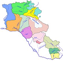
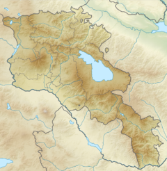
The Vorotan (Armenian: Որոտան), or Bargushad (Armenian: Բարգուշատ, Azerbaijani: Bərgüşad) or Bazarchay (Azerbaijani: Bazarçay), is a river in the South Caucasus that is the largest right tributary of the Hakari river.[1] It starts from the northwestern slopes of the Syunik Plateau, from the Tsalk pond and adjacent springs at an altitude of 3,045 m, receives the water of streams flowing from several small ponds, as well as the springs of Gorayk village, then it flows in a southeastern direction through the territory of Sisian and Goris regions.[2][3] It flows through Armenia for 119 kilometres (74 mi) in a generally south-easterly direction. The river enters Azerbaijan again, flowing for 43 km (27 mi) through the districts of Qubadli and Zangilan. The lower section of the Hakari, from its confluence with the Vorotan until its confluence with the Aras river, is sometimes considered to be part of the Vorotan.[4][5][6]
- ^ "Հագարի" [Hagari]. Dictionary of toponyms of Armenia and adjacent regions (in Armenian). Vol. 3. Yerevan: Yerevan University Publishing House. 2001. p. 299.
- ^ Ayvazyan, Hovhannes (2006). The Nature of Armenia (encyclopedia) (Հայաստանի բնաշխարհ (հանրագիտարան)). Yerevan: «Հայկական հանրագիտարան» հրատարակչություն. p. 162. ISBN 5897000298.
- ^ «Գեոդեզիայի և քարտեզագրության կենտրոն ՊՈԱԿ» (2007). Հայաստանի Հանրապետության Ֆիզիկաաշխարհագրական օբյեկտների համառոտ տեղեկատու-բառարան. Yerevan: Mapa. p. 97.
- ^ "Армянский министр: Истоки двух основных рек Воротан и Арпа, питающих озеро Севан, находятся в карабахском районе Карвачар (Кельбаджар), который после войны перешел под контроль Азербайджана – Новости". dialogorg.ru. January 26, 2021. Retrieved June 17, 2022.
- ^ Воротан, Great Soviet Encyclopedia
- ^ "Rivers of Armenia". Armenia Discovery. Retrieved July 6, 2021.


