Vukovar-Srijem County
Vukovarsko-srijemska županija (Croatian) | |
|---|---|
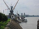
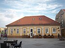
Vukovar-Srijem County photos | |
 Vukovar-Srijem County within Croatia | |
| Coordinates: 45°13′43″N 18°55′00″E / 45.22861°N 18.91667°E | |
| Country | Croatia |
| County seat Largest City | Vukovar Vinkovci |
| Government | |
| • Župan | Franjo Orešković (acting) (HDZ) |
| Area | |
| • Total | 2,454 km2 (947 sq mi) |
| Elevation | 78−224 m (255−734 ft) |
| Population (2021) | |
| • Total | 144,438 |
| • Density | 59/km2 (150/sq mi) |
| Postal code | 32xxx |
| Area code | 32 |
| ISO 3166 code | HR-16 |
| Vehicle registration | VK, VU, ŽU |
| Assembly and Executive Headquarters | Palace of Syrmia County |
| HDI (2022) | 0.828[2] very high · 18th |
| Website | Official site |
Vukovar-Srijem County (Croatian: Vukovarsko-srijemska županija), Vukovar-Sirmium County or Vukovar-Syrmia County, named after the eponymous town of Vukovar and the region of Syrmia, is the easternmost Croatian county. It includes the eastern parts of the region of Slavonia and the western parts of the region of Syrmia, as well as the lower Sava river basin, Posavina and Danube river basin Podunavlje. Due to the overlapping definitions of geographic regions, division on Slavonia and Syrmia approximately divides the county vertically into north-west and south-east half, while division on Posavina and Podunavlje divides it horizontally on north-east and south-west half.
The county's seat is in Vukovar, a town on the Danube river while its biggest town and economic and transportation center is in Vinkovci, town with 33,328 inhabitants. Vinkovci served as a temporary de facto seat of the county during the Croatian War of Independence with some institutions still remaining in the town as of 2020.[3] In 2011 the entire population of the county was 180,117. Other than Vukovar and Vinkovci, settlements with town status are Ilok, Otok and Županja. Vukovar-Srijem County is ethnically most diverse county in Croatia with Croat majority and significant Serb, Hungarian, Pannonian Rusyns, Bosniak, Ukrainian and Slovak communities.
The county was one of the most affected regions by the Croatian War of Independence and today belongs to the group of the least developed counties in Croatia with significant part of it being classified as an Areas of Special State Concern.
- ^ Ostroški, Ljiljana, ed. (December 2015). Statistički ljetopis Republike Hrvatske 2015 [Statistical Yearbook of the Republic of Croatia 2015] (PDF). Statistical Yearbook of the Republic of Croatia (in Croatian and English). Vol. 47. Zagreb: Croatian Bureau of Statistics. p. 62. ISSN 1333-3305. Retrieved 27 December 2015.
- ^ "Sub-national HDI - Area Database - Global Data Lab". hdi.globaldatalab.org. Retrieved 2024-10-10.
- ^ "Županijski adresar". www.vusz.hr (in Croatian). Retrieved 2 July 2020.


