WAIS Divide Camp | |
|---|---|
Camp | |
 WAIS Divide Field Camp in 2012 | |
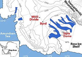
 Detailed Map of the WAIS Divide Region | |
| Coordinates: 79°28′05″S 112°05′10″W / 79.468°S 112.086°W | |
| Country | |
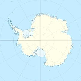
| Location in Antarctica | WAIS Divide Antarctica |
| Administered by | National Science Foundation |
| Established | 2005 |
| Elevation | 1,797 m (5,896 ft) |
| Type | Seasonal |
| Status | Operational |
WAIS Divide airfield | |||||||||||
|---|---|---|---|---|---|---|---|---|---|---|---|
 New York Air National Guard LC-130H being unloaded by a Caterpillar loader at the WAIS Divide field camp. | |||||||||||
| Summary | |||||||||||
| Airport type | Private | ||||||||||
| Location | West Antarctic Ice Sheet | ||||||||||
| Opened | 2005 | ||||||||||
| Elevation AMSL | 5,895 ft / 1,797 m | ||||||||||
| Coordinates | 79°28′25″S 112°04′02″W / 79.473695°S 112.067194°W | ||||||||||
| Map | |||||||||||
 | |||||||||||
| Runways | |||||||||||
| |||||||||||
The WAIS Divide is the ice flow divide on the West Antarctic Ice Sheet (WAIS) which is a linear boundary that separates the region where the ice flows to the Ross Sea, from the region where the ice flows to the Weddell Sea. It is similar to a continental hydrographic divide.
