Wabeno, Wisconsin | |
|---|---|
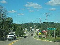
 Looking west at the community of Wabeno skyline on WIS 32 | |
 Location of Wabeno, Wisconsin | |
| Coordinates: 45°26′31″N 88°34′11″W / 45.44194°N 88.56972°W | |
| Country | |
| State | |
| County | Forest |
| Area | |
| • Total | 108.3 sq mi (280.5 km2) |
| • Land | 107.3 sq mi (278.0 km2) |
| • Water | 0.9 sq mi (2.5 km2) |
| Elevation | 1,371 ft (418 m) |
| Population (2010) | |
| • Total | 1,166 |
| • Density | 11/sq mi (4.2/km2) |
| Time zone | UTC-6 (Central (CST)) |
| • Summer (DST) | UTC-5 (CDT) |
| Area code(s) | 715 & 534 |
| FIPS code | 55-83025[2] |
| GNIS feature ID | 1584337[1] |
| Website | http://townofwabeno.org/ |
Wabeno is a town in Forest County, Wisconsin, United States. The population was 1,166 at the 2010 census.[3] The census-designated place of Wabeno and the unincorporated communities of Carter, Padus, and Soperton are located in the town. Wabeno is situated within Wisconsin's 7th congressional district.
- ^ a b "US Board on Geographic Names". United States Geological Survey. October 25, 2007. Retrieved January 31, 2008.
- ^ "U.S. Census website". United States Census Bureau. Retrieved January 31, 2008.
- ^ "Race, Hispanic or Latino, Age, and Housing Occupancy: 2010 Census Redistricting Data (Public Law 94-171) Summary File (QT-PL), Wabeno town, Wisconsin". United States Census Bureau. Retrieved August 12, 2011.