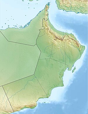
| Wadi Hatta Wādī Ḥattā | |
|---|---|
 | |
| Native name | وادي حتّا (Arabic) |
| Location | |
| Country | |
| Governorate Emirate | Al Batinah North |
| Physical characteristics | |
| Source | Southern slope of Um Alnosoor / Jabal Hatta (1,280 m (4,200 ft)) |
| • elevation | 1,192 m (3,911 ft) (approximately) |
| Mouth | Al Widayyat City, wilaya of Shinas, in the Gulf of Oman. |
• coordinates | 24°47′4.74″N 56°27′31.61″E / 24.7846500°N 56.4587806°E |
• elevation | 0 m (0 ft) |
| Length | 57 km (35 mi) |
| Basin size | 548 km2 (212 sq mi) |
| Basin features | |
| Progression | Wadi. Intermittent flow |
| River system | Wadi Hatta |
| Tributaries | |
| • left | Wadi Hadf, Wadi Wahiyah, Wadi Umm Daqqayn and Wadi Massayid. |
| • right | Wadi Qimah, Wadi al Qahfi, Wadi Nasub, Wadi Khabab, Wadi Sufaydah and Wadi Ashar. |
The Wadi Hatta (Arabic: وادي حتّا, romanized: Wādī Ḥattā) [1][2][3] is a valley or dry river with ephemeral or intermittent flow, which flows almost exclusively during the rainy season, located north of Oman, in the Al Batinah North; and to the east of the United Arab Emirates, in the enclave of Hatta (Dubai).
It forms its own drainage basin, covering an area of approximately 548 km2 (212 sq mi),[4] and is bordered to the north by the Wadi Al Qor; to the south by the Wadi Fayd; and to the west by the Mahadah drainage basin (Wadi Andhayrah, Wadi Khuraymah, Wadi Mayhah and others, flowing into the large alluvial plain of Madam Plain and the Wadi Yudayyah).[5][6]
The main wadi, which gives its name to the entire drainage basin, is the Wadi Hatta, with numerous tributaries and sub-tributaries forming an important drainage network composed by hundreds of independent streams, most of them unnamed.[5]
The main tributaries are:
- In Oman: Wadi Umm Daqqayn, [7] Wadi al Qahfi, [8][9] Wadi Nasub,[10] Wadi Massayid, [11] Wadi Khabab,[12] Wadi Sufaydah [13] and Wadi Ashar.
- In UAE: Wadi Hadf, [8][14] Wadi Qimah [15] and Wadi Wahiyah.[16]
- ^ Jāmiʻat al-Imārāt al-ʻArabīyah al-Muttaḥidah. Geoprojects (U.K.) Ltd., The National atlas of the United Arab Emirates, Al Ain : United Arab Emirates University - 1993
- ^ Trucial States, Muscat and Oman: Aswad - Scale 1:100 000 - Published by D Survey, Ministry of Defense, United Kingdom (1971) - Edition 3-GSGS - The National Archives, London, England <https://www.agda.ae/en/catalogue/tna/fco/18/1796/n/1>
- ^ Mindat.org - Wādī Ḩattā, United Arab Emirates
- ^ Ramsar Information Sheet - United Arab Emirates - Hatta Mountain Reserve, 2019
- ^ a b El-Baz, Farouk & Kusky, Timothy & Koch, Magaly & Robinson, Cordula & Fielding, Lynne & Blanco-Ward, Daniel & Al-Rawas, Ghazi & Ozdogan, Mutlu & Oakley, Susan & Inzana, Jennifer. (2002). Wadis of Oman, Satellite Image Atlas, prepared by Center for Remote Sensing, Boston University, U.S.A. London: Stacey International. ISBN 1900988569.
{{cite book}}: CS1 maint: multiple names: authors list (link) - ^ FCO 18/1795 - Oman and the United Arab Emirates (UAE): Jebel Al Rawdah - Scale 1:100 000 - Published by D Survey, Ministry of Defence, United Kingdom (1970) - Edition 3-GSGS - The National Archives, London, England <https://www.agda.ae/en/catalogue/tna/fco/18/1795>
- ^ Mindat.org - Wādī Umm ad Daqqayn, United Arab Emirates
- ^ a b Tribulus - Volume 8.2 - 1998 - Journal of the Emirates Natural History Group - Wadi Fish of the UAE - Gary R. Feulner - Abu Dhabi, United Arab Emirates, 1998 <https://enhg.org/Portals/1/trib/V08N2/TribulusV08N2Searchable.pdf>
- ^ Gazetteer of the Persian Gulf. Vol. II. Geographical and Statistical. J G Lorimer. 1908', British Library: India Office Records and Private Papers, IOR/L/PS/20/C91/4, in Qatar Digital Library <https://iiif.qdl.qa/iiif/images/81055/vdc_100023486173.0x000001/IOR_L_MIL_17_16_2_2_0178.jp2/full/!120 0.1200/0/default.jpg>
- ^ Mindat.org - Wādī Nāşib, Al Batinah North Governorate, Oman
- ^ Mindat.org - Wādī al Musayyid, Al Batinah North Governorate, Oman
- ^ Mindat.org - Wādī al Khabāb, Al Batinah North Governorate, Oman
- ^ Mindat.org - Wādī Şuqaydah, Al Batinah North Governorate, Oman
- ^ Tribulus - Volume 9.2 - 1999 - Journal of the Emirates Natural History Group (page . 26-28)- A Mountain Wadi that Flows to Both the Arabian Gulf and the Gulf of Oman - Gary R. Feulner - Abu Dhabi, United Arab Emirates, 1999 <https://enhg.org/Portals/1/trib/V09N2/TribulusV09N2Searchable.pdf>
- ^ Mindat.org - Wādī Qimah, Dubai, United Arab Emirates
- ^ Mindat.org - Wādī Wahīyah, Dubai, United Arab Emirates


