Waghemira
ዋግ ኽምራ | |
|---|---|
 | |
| Country | Ethiopia |
| Region | Amhara |
| Area | |
| • Total | 9,039.04 km2 (3,489.99 sq mi) |
| Population (2017 est.) | |
| • Total | 463,505 |
| • Density | 51/km2 (130/sq mi) |
Preview warning: Page using Template:Infobox settlement with unknown parameter "population footnotes"

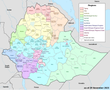
Wag Hemra (Amharic: ዋግ ኽምራ) is a Zone in the Amhara Region of Ethiopia. Its name is a combination of the former province of Wag, and the dominant local ethnic group, the Kamyr (or "Hemra") Agaw.[2] Wag Hemra is bordered on the south by Semien Wollo, on the southwest by Debub (South) Gondar, on the west by Semen (North) Gondar, and on the north and east by the Tigray Region. Towns in Wag Hemra include Soqota.
- ^ a b Geohive: Ethiopia Archived 2012-08-05 at the Wayback Machine
- ^ Sarah Vaughan, "Ethnicity and Power in Ethiopia" (University of Edinburgh: Ph.D. Thesis, 2003), pp. 239ff