| Walgett New South Wales | |||||||||
|---|---|---|---|---|---|---|---|---|---|
 Main street, Walgett (Fox Street/Castlereagh Highway) looking south over Wee Waa Street | |||||||||
| Coordinates | 30°01′0″S 148°07′0″E / 30.01667°S 148.11667°E | ||||||||
| Population | 2,145 (2016 census)[1] | ||||||||
| Postcode(s) | 2832 | ||||||||
| Elevation | 133 m (436 ft) | ||||||||
| Location |
| ||||||||
| LGA(s) | Walgett Shire | ||||||||
| County | Baradine | ||||||||
| State electorate(s) | Barwon | ||||||||
| Federal division(s) | Parkes | ||||||||
| |||||||||


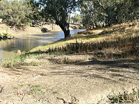
Walgett is a town in northern New South Wales, Australia, and the seat of Walgett Shire. It is near the junctions of the Barwon and Namoi Rivers and the Kamilaroi and Castlereagh Highways. In 2016, Walgett had a population of 2,145.[1]
In the 2016 census, there were 6,107 people in the Walgett Local Government Area. Of these 52.9% were male and 47.1% were female. Aboriginal and/or Torres Strait Islander people made up 29.4% of the population. Walgett takes its name from an Aboriginal word meaning 'the meeting place of two rivers'.[2] The town was listed as one of the most socially disadvantaged areas in the State according to the 2015 Dropping Off The Edge report.[3]
- ^ a b Australian Bureau of Statistics (27 June 2017). "Walgett (State Suburb)". 2016 Census QuickStats. Retrieved 28 January 2020.
 Material was copied from this source, which is available under a Creative Commons Attribution 4.0 International License.
- ^ You are in: Walgett About NSW
- ^ Taylor, Josie; Branley, Alison. "Dropping Off The Edge: Select suburbs stuck in cycle of disadvantage with little being done to help, report shows". ABC News. Retrieved 25 July 2015.
