| Wallaga Lake | |
|---|---|
 | |
| Location | Bega Valley Shire, New South Wales, Australia |
| Coordinates | 36°22′07″S 150°03′27″E / 36.36869°S 150.05762°E |
| Type | Estuarine lake |
| Primary inflows | Dignams Creek, Narira Creek, and tributaries |
| Primary outflows | Intermittently Closed and Open Lake or Lagoon (ICOLL) |
| Catchment area | 280 km2 (110 sq mi) |
| Basin countries | Australia |
| Surface area | 7.8 km2 (3.0 sq mi) |
| Islands | Merriman's Island |
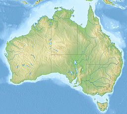
Wallaga Lake is an estuarine lake in Bega Valley Shire in New South Wales, Australia,[1] the largest lake in southern NSW.[2] It is located between Bermagui to the south and between Tilba Tilba to the north,[1] situated beneath Mount Gulaga, in the traditional lands of the Yuin people.[2] A large section of its foreshore and catchment are within the Gulaga National Park,[1] since Wallaga Lake National Park, Goura Nature Reserve, and Mt Dromedary Flora Reserve were combined into the larger national park.[3] There is an island in the lake known as Merriman's Island, Merriman Island or Umbarra.
The lake's surface area is 7.8 km2 (3.0 sq mi), while its catchment area spans 280 km2 (110 sq mi), consisting mainly of Dignams Creek and Narira Creek and tributaries. While the lake itself and most of its catchment fall within the Bega Valley Shire, the northern part of the catchment lies within Eurobodalla Shire Council. It is classified as an Intermittently Closed and Open Lake or Lagoon (ICOLL), because the entrance of the lake sometimes allows tidal exchange from the ocean, but at other times is closed off by a sand bar at the beach.[1] It is a popular spot for recreational fishing, sailing, bushwalking and birdwatching.[2]

- ^ a b c d "Wallaga Lake Coastal Management Program: Background information". Bega Valley Shire Council. Retrieved 6 July 2021.
- ^ a b c "Wallaga Lake". Visit NSW. Retrieved 6 July 2021.
- ^ "Biamanga and Gulaga National Park Aboriginal Ownership and Leaseback Agreements". NSW Environment, Energy and Science. Retrieved 7 July 2021. PDF
 Text may have been copied from this source, which is available under a Attribution 4.0 International (CC BY 4.0) licence. (see here.)
