| Wallis Lake | |
|---|---|
 | |
| Location | Mid North Coast, New South Wales, Australia |
| Coordinates | 32°18′S 152°30′E / 32.300°S 152.500°E |
| Lake type | An open and trained wave dominated barrier estuary[1] |
| Primary inflows | Wallamba River, Coolongolook River, Pipers Creek |
| Primary outflows | Coolongolook River to the Tasman Sea |
| Catchment area | 1,196.9 square kilometres (462.1 sq mi)[2] |
| Basin countries | Australia |
| Managing agency | Mid-Coast Council |
| Max. length | 25 kilometres (16 mi)[3] |
| Max. width | 9 kilometres (5.6 mi)[4] |
| Surface area | 98.7 square kilometres (38.1 sq mi)[2] |
| Average depth | 2.3 metres (7 ft 7 in)[2] |
| Water volume | 217,951.5 megalitres (7,696.88×106 cu ft)[2] |
| Surface elevation | 0 m (0 ft) |
| Islands | Hadleys Island, Wallis Island |
| Settlements | Coomba Park, Forster, Green Point, Pacific Palms, Tuncurry |
| Website | NSW Environment & Heritage webpage |
| References | [5] |
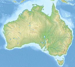
Wallis Lake, an open and trained wave dominated barrier estuary,[1] is located within the Mid-Coast Council local government area in the Mid North Coast region of New South Wales, Australia. Wallis Lake is located adjacent to the towns of Forster and Tuncurry, and adjacent to the east coast, about 308 kilometres (191 mi) north of Sydney.
- ^ a b Roy, P. S; Williams, R. J; Jones, A. R; Yassini, I; et al. (2001). "Structure and Function of South-east Australian Estuaries". Estuarine, Coastal and Shelf Science. 53: 351–384. doi:10.1006/ecss.2001.0796.
- ^ a b c d Cite error: The named reference
OEHwas invoked but never defined (see the help page). - ^ "Wallis Lake". Great Lakes Tourism. Great Lakes Council. Retrieved 20 March 2013.
- ^ "Wallis Lake". Geographical Names Register (GNR) of NSW. Geographical Names Board of New South Wales. Retrieved 20 March 2013.
- ^ "Map of Wallis Lake, NSW". Bonzle Digital Atlas of Australia. Retrieved 20 March 2013.

