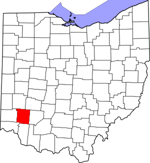
Warren County | |
|---|---|
 Warren County Administration Building in Lebanon, Ohio | |
 Location within the U.S. state of Ohio | |
 Ohio's location within the U.S. | |
| Coordinates: 39°26′N 84°10′W / 39.43°N 84.17°W | |
| Country | |
| State | |
| Founded | May 1, 1803[1] |
| Named for | Dr. Joseph Warren |
| Seat | Lebanon |
| Largest city | Mason |
| Area | |
| • Total | 407 sq mi (1,050 km2) |
| • Land | 401 sq mi (1,040 km2) |
| • Water | 6.0 sq mi (16 km2) 1.5% |
| Population (2020) | |
| • Total | 242,337 |
| • Estimate (2021) | 246,553 |
| • Density | 600/sq mi (230/km2) |
| Time zone | UTC−5 (Eastern) |
| • Summer (DST) | UTC−4 (EDT) |
| Congressional district | 1st |
| Website | co |
Warren County is a county located in the southwestern part of the U.S. state of Ohio. As of the 2020 census, the population was 242,337.[2] Its county seat is Lebanon and largest city is Mason.[3] The county is one of Ohio's most affluent, with the highest median income of the state's 88 counties. The county was established on May 1, 1803, from Hamilton County; it is named for Dr. Joseph Warren, a hero of the Revolution who sent Paul Revere and the overlooked William Dawes on their famous rides and who died at the Battle of Bunker Hill.[4] Warren County is part of the Cincinnati, OH-KY-IN Metropolitan Statistical Area.
- ^ "Ohio County Profiles: Warren County" (PDF). Ohio Department of Development. Archived from the original (PDF) on May 8, 2007. Retrieved April 28, 2007.
- ^ "State & County QuickFacts". United States Census Bureau. Retrieved July 7, 2022.
- ^ "Find a County". National Association of Counties. Archived from the original on May 31, 2011. Retrieved June 7, 2011.
- ^ "Warren County data". Ohio State University Extension Data Center. Retrieved April 28, 2007. [dead link]

