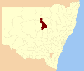
| Warren Shire New South Wales | |||||||||||||||
|---|---|---|---|---|---|---|---|---|---|---|---|---|---|---|---|
 Location in New South Wales | |||||||||||||||
 Warren Shire Council Administration Office, 2017 | |||||||||||||||
| Coordinates | 31°42′S 147°50′E / 31.700°S 147.833°E | ||||||||||||||
| Population |
| ||||||||||||||
| • Density | 0.26/km2 (0.67/sq mi) | ||||||||||||||
| Established | 1 January 1957[3] | ||||||||||||||
| Area | 10,760 km2 (4,154.5 sq mi) | ||||||||||||||
| Mayor | Milton Quigley (Unaligned) | ||||||||||||||
| Council seat | Warren | ||||||||||||||
| Region | Orana | ||||||||||||||
| State electorate(s) | Barwon | ||||||||||||||
| Federal division(s) | Parkes | ||||||||||||||
 | |||||||||||||||
| Website | Warren Shire | ||||||||||||||
| |||||||||||||||
Warren Shire is a local government area in the Orana region of New South Wales, Australia. The Shire is located adjacent to the Macquarie River and the Mitchell and Oxley Highways. The use of the area is mainly for wool and cotton growing.
The shire was formed on 1 January 1957 through the amalgamation of Marthaguy Shire with the Municipality of Warren.[3] The shire includes the regional towns of Warren and Nevertire.
The mayor of Warren Shire Council is Cr. Milton Quigley, who is unaligned with any political party.
- ^ Australian Bureau of Statistics (27 June 2017). "Warren (A)". 2016 Census QuickStats. Retrieved 7 July 2017.
- ^ "3218.0 – Regional Population Growth, Australia, 2017–18". Australian Bureau of Statistics. 27 March 2019. Retrieved 27 March 2019. Estimated resident population (ERP) at 30 June 2018.
- ^ a b "Local Government Act 1919. Proclamation (129)". Government Gazette of the State of New South Wales. 30 November 1956. p. 3513. Retrieved 11 January 2020 – via National Library of Australia.