Warsaw, Ohio | |
|---|---|
 The Walhonding River in Warsaw | |
 Location of Warsaw, Ohio | |
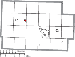
 Location of Warsaw in Coshocton County | |
| Coordinates: 40°20′06″N 81°59′57″W / 40.33500°N 81.99917°W | |
| Country | United States |
| State | Ohio |
| County | Coshocton |
| Township | Jefferson |
| Established | 1834 |
| Area | |
| • Total | 0.50 sq mi (1.30 km2) |
| • Land | 0.49 sq mi (1.26 km2) |
| • Water | 0.01 sq mi (0.04 km2) |
| Elevation | 797 ft (243 m) |
| Population (2020) | |
| • Total | 634 |
| • Density | 1,304.53/sq mi (503.23/km2) |
| Time zone | UTC−05:00 (Eastern (EST)) |
| • Summer (DST) | UTC−04:00 (EDT) |
| ZIP Code | 43844 |
| Area code | 740 |
| FIPS code | 39-81032 |
| GNIS feature ID | 2400096[2] |
| Website | https://warsawohio.us/ |
Warsaw is a village in Coshocton County, Ohio, United States, along the Walhonding River.[3] The population was 624 at the 2020 census.
- ^ "ArcGIS REST Services Directory". United States Census Bureau. Retrieved September 20, 2022.
- ^ a b U.S. Geological Survey Geographic Names Information System: Warsaw, Ohio
- ^ DeLorme (1991), Ohio Atlas & Gazetteer, Yarmouth, Maine ISBN 0-89933-233-1