Waseca County | |
|---|---|
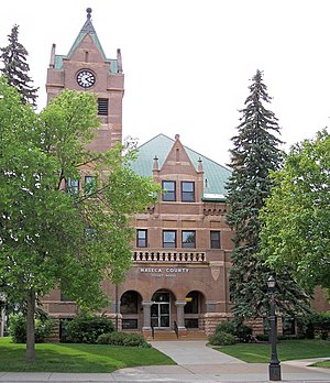
 Waseca County Courthouse in 2007 | |
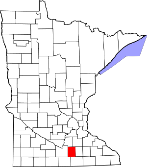
 Location within the U.S. state of Minnesota | |
 Minnesota's location within the U.S. | |
| Coordinates: 44°01′N 93°35′W / 44.02°N 93.59°W | |
| Country | |
| State | |
| Founded | February 27, 1857[1] |
| Named for | Waseca (settlement) |
| Seat | Waseca |
| Largest city | Waseca |
| Area | |
| • Total | 433 sq mi (1,120 km2) |
| • Land | 423 sq mi (1,100 km2) |
| • Water | 9.6 sq mi (25 km2) 2.2% |
| Population (2020) | |
| • Total | 18,968 |
| • Estimate (2023) | 18,981 |
| • Density | 44/sq mi (17/km2) |
| Time zone | UTC−6 (Central) |
| • Summer (DST) | UTC−5 (CDT) |
| Congressional district | 1st |
| Website | www |
Waseca County (/wəˈsiːkə/)[2] is a county in the U.S. state of Minnesota. As of the 2020 census, the population was 18,968.[3] Its county seat is Waseca.[4]
- ^ "Minnesota Place Names". Minnesota Historical Society. Retrieved March 19, 2014.
- ^ "5 More Minnesota Towns You're Pronouncing Wrong".
- ^ "State & County QuickFacts". United States Census Bureau. Retrieved April 19, 2023.
- ^ "Find a County". National Association of Counties. Retrieved June 7, 2011.