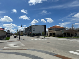
West Fargo, North Dakota | |
|---|---|
| Motto: "A City on the Grow" | |
 Location of West Fargo, North Dakota | |
| Coordinates: 46°52′20″N 96°52′18″W / 46.87222°N 96.87167°W | |
| Country | United States |
| State | North Dakota |
| County | Cass |
| Founded | 1871 |
| Incorporated | 1930[1] |
| Government | |
| • Type | City Commission |
| • President | Bernie Dardis |
| • Commission | Members list |
| Area | |
| • City | 16.417 sq mi (42.520 km2) |
| • Land | 16.175 sq mi (41.893 km2) |
| • Water | 0.242 sq mi (0.627 km2) |
| Elevation | 899 ft (274 m) |
| Population | |
| • City | 38,626 |
| • Estimate (2023)[6] | 40,400 |
| • Rank | US: 994th ND: 5th |
| • Density | 2,498.0/sq mi (964.4/km2) |
| • Urban | 216,214 (US: 178th)[3] |
| • Urban density | 2,781.6/sq mi (1,074.0/km2) |
| • Metro | 262,620 (US: 189th) |
| • Metro density | 93.4/sq mi (36.08/km2) |
| Demonym | West Fargoan |
| Time zone | UTC–6 (Central (CST)) |
| • Summer (DST) | UTC–5 (CDT) |
| ZIP Code | 58078 |
| Area code | 701 |
| FIPS code | 38-84780 |
| GNIS feature ID | 1036321[4] |
| Highways | I-94, US 10 |
| Sales tax | 8.0%[7] |
| Website | westfargond.gov |
West Fargo is a city in Cass County, North Dakota, United States. It is, as of the 2020 census, the fifth most populous city in the state of North Dakota with a population of 38,626,[5] and it is one of the state's fastest growing cities.[8] The city is part of the Fargo-Moorhead, ND-MN Metropolitan Statistical Area.
- ^ "History of West Fargo". www.westfargond.gov. Retrieved June 9, 2024.
- ^ "2023 U.S. Gazetteer Files". United States Census Bureau. Retrieved June 12, 2024.
- ^ "List of 2020 Census Urban Areas". census.gov. United States Census Bureau. Retrieved June 12, 2024.
- ^ a b U.S. Geological Survey Geographic Names Information System: West Fargo, North Dakota
- ^ a b "Explore Census Data". United States Census Bureau. Retrieved June 1, 2022.
- ^ Cite error: The named reference
USCensusEst2023was invoked but never defined (see the help page). - ^ "West Fargo (ND) sales tax rate". Retrieved June 12, 2024.
- ^ "West Fargo, ND | Official Website". www.westfargond.gov.


