| West Fork River | |
|---|---|
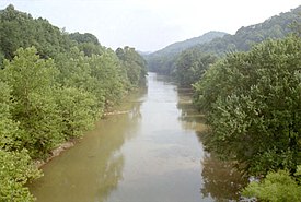
 The West Fork River in Enterprise, July 1996 | |
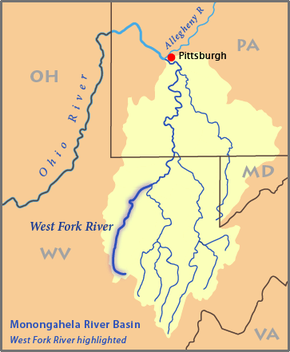
 Map of the Monongahela River basin, with the West Fork River highlighted | |
| Location | |
| Country | United States |
| State | West Virginia |
| Counties | Upshur, Lewis, Harrison, Marion |
| Physical characteristics | |
| Source | Confluence of Straight Fork and Whites Camp Fork |
| • location | near Rock Cave, Upshur County |
| • coordinates | 38°51′08″N 80°21′32″W / 38.85222°N 80.35889°W[1] |
| • elevation | 1,309 ft (399 m)[2] |
| Mouth | Monongahela River |
• location | Fairmont |
• coordinates | 39°27′53″N 80°09′11″W / 39.46472°N 80.15306°W[1] |
• elevation | 863 ft (263 m)[1] |
| Length | 103 mi (166 km)[3] |
| Basin size | 881 sq mi (2,280 km2)[4] |
| Discharge | |
| • location | mouth |
| • average | 1,373.37 cu ft/s (38.890 m3/s) (estimate)[5] |
The West Fork River is a principal tributary of the Monongahela River, 103-mile (166 km) long, in north-central West Virginia, United States. Via the Monongahela and Ohio Rivers, it is part of the watershed of the Mississippi River, draining an area of 881 square miles (2,284 km²) on the unglaciated portion of the Allegheny Plateau.
- ^ a b c Geographic Names Information System. "Geographic Names Information System entry for West Fork River (Feature ID #1548931)". Retrieved 2007-02-12.
- ^ Geographic Names Information System. "Geographic Names Information System entry for Straight Fork (Feature ID #1547564)". Retrieved 2007-02-12.
- ^ Venable, Wallace (2006). "West Fork River". In Ken Sullivan (ed.). The West Virginia Encyclopedia. Charleston, WV: West Virginia Humanities Council. p. 758. ISBN 0-9778498-0-5.
- ^ West Virginia Department of Environmental Protection. "Watershed Atlas Project". pp. West Fork River. Archived from the original on 2005-04-04. Retrieved 2007-02-26.
- ^ United States Environmental Protection Agency. "Watershed Report: West Fork River". watersgeo.epa.gov. Archived from the original on 2021-07-03. Retrieved 2021-07-03.