Westerlo | |
|---|---|
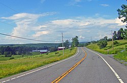
 State Route 32 - Westerlo | |
 Location in Albany County and the state of New York. | |
| Coordinates: 42°30′41″N 74°2′46″W / 42.51139°N 74.04611°W | |
| Country | United States |
| State | New York |
| County | Albany |
| Government | |
| • Type | Town Council |
| • Supervisor | Matthew A. Kryzak (Republican Party) |
| • Town Council | Members' List |
| Area | |
| • Total | 58.54 sq mi (151.61 km2) |
| • Land | 57.79 sq mi (149.68 km2) |
| • Water | 0.74 sq mi (1.93 km2) |
| Elevation | 1,142 ft (348 m) |
| Population | |
| • Total | 3,194 |
| Time zone | UTC-5 (Eastern (EST)) |
| • Summer (DST) | UTC-4 (EDT) |
| ZIP codes | 12055, 12193 |
| Area code | 518 |
| FIPS code | 36-001-79851 |
| GNIS feature ID | 0979619[3] |
| Website | townofwesterlony |
Westerlo is a town in Albany County, New York, United States. The population was 3,194 at the 2020 census.
The town is on the southern border of Albany County and is served by New York State Route 143.
- ^ "2016 U.S. Gazetteer Files". United States Census Bureau. Retrieved July 4, 2017.
- ^ US Census Bureau, 2020 Census, Westerlo town, Albany County, New York https://www.census.gov/search-results.html?searchType=web&cssp=SERP&q=Westerlo%20town,%20Albany%20County,%20New%20York
- ^ "US Board on Geographic Names". United States Geological Survey. October 25, 2007. Retrieved January 31, 2008.